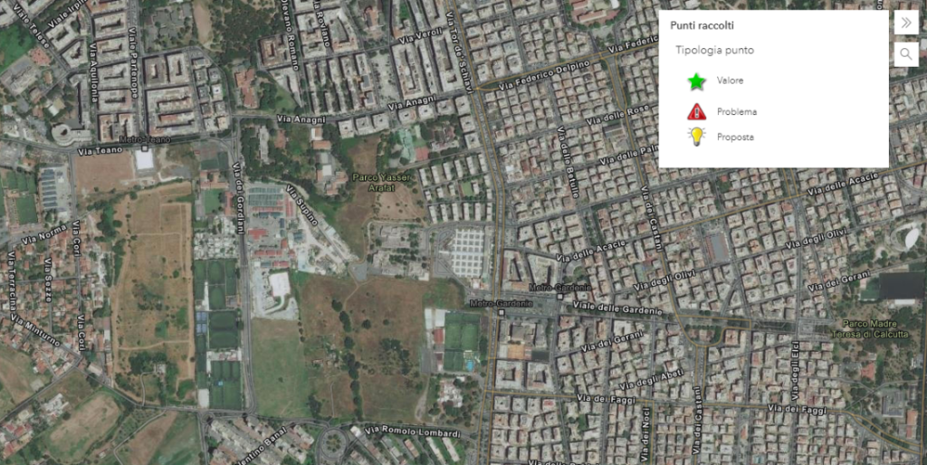
“MenteLocale” project, developed by LabSU (the Laboratory of Urban Studies Territories of Living of the DICEA – La Sapienza University), with the support and participation of the Paolo Bulgari Foundation, aims to “experiment collaborative ways of production of territorial knowledge and co-design of the ecological network in the eastern quadrant of Rome”. Through the use of civic technologies capable of raising awareness and stimulating citizen participation, the project intends to carry out a process of collaborative mapping in order to promote the construction of a network of active citizens, and intends to enrich the project through the involvement of schools.
Needs: the park’s partecipatory census
Paolo Bulgari Foundation and Dicea have structured an activity to be conducted within a project involving students of the Comprehensive Institute “Largo Cocconi” in Rome. The activity includes the involvement of students in the census within the Park “Somaini-Arafat” of Rome of points corresponding to 3 categories: elements that represent a value for the park, elements that represent problems/risks, and finally, ideas for the regeneration of the park. The activity is part of the broader participation of the rehabilitation of areas and the design of a more efficient, sustainable and close to the population.
Solution: Application Configuration
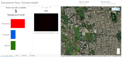
gisAction designed a workflow to support the field census activity based on GIS tools. The tools have been configured through the ArcGIS Online platform that the Institute is equipped with thanks to the ArcGIS software bundle that Esri donates for free to schools around the world. The workflow involves the use of the QuickCapture for ArcGIS application to be installed on smartphones through which students can geolocate points in the Park corresponding to values, problems and proposals. For each point it is also possible to enter descriptive data. The captured points will be visible in maps and dashboards in which it will be possible to aggregate them and view customized statistics. In addition to the implementation of the applications, gisAction has trained the staff that will manage the project and that will interface with the students, regarding the management of the implemented applications and basic knowledge for the maintenance of the ArcGIS Online platform.
Benefits: a more efficient process
The designed flow allows for efficient collection of information in the field. It allows in a simple way to capture geolocated points and review them on a map along with the collected data. The applications are easy for students to use, but have great visualization potential. The tools support local development and mapping projects.
Who we worked with
Paolo Bulgari Foundation is an association based in Rome that is committed to the promotion of the fight against inequalities and educational poverty, support for children and youth employment in sensitive areas.
DICEA is a Department founded in 2010 that focuses its scientific and teaching activities on the complex and articulated issues of architectural design and urban planning, civil engineering and environmental engineering.
