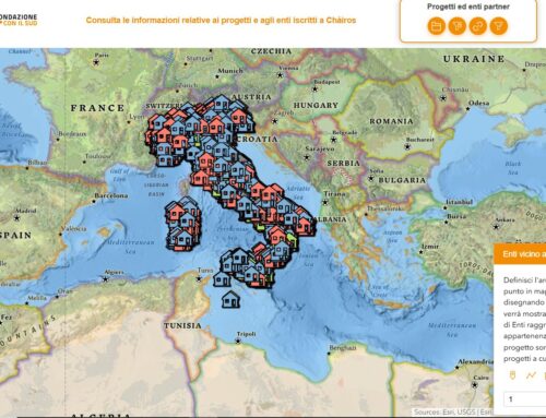
The National Institute of Statistics of Albania (INSTAT) has introduced GIS technology into its population and housing census program with the support of gisAction
Geospatial technologies have assumed a key role in the activities of statistical institutes and, in particular, in population and housing censuses. If the geographical component has always been an integral part of census operations through the mapping of elements, today the technological evolution has made it necessary to adopt geographical tools in the strategy planning. Using GIS in censuses means modernizing the entire workflow, digitizing processes, reducing costs, monitoring the progress of operations, and disseminating results efficiently.
Needs: innovating the national census
The methodology used in international censuses has changed radically in many countries around the world, which have abandoned the traditional process of information collection in favor of digital data management systems built with GIS technology. In Albania, in 2011 INSTAT introduced geospatial tools in census operations, entrusting gisAction with the construction of a digital geographic infrastructure for data collection, aggregation, analysis and dissemination. This enabled an important process of innovation to bring census operations up to the best international standards that continues today.
Solution: Geospatial technologies for the census
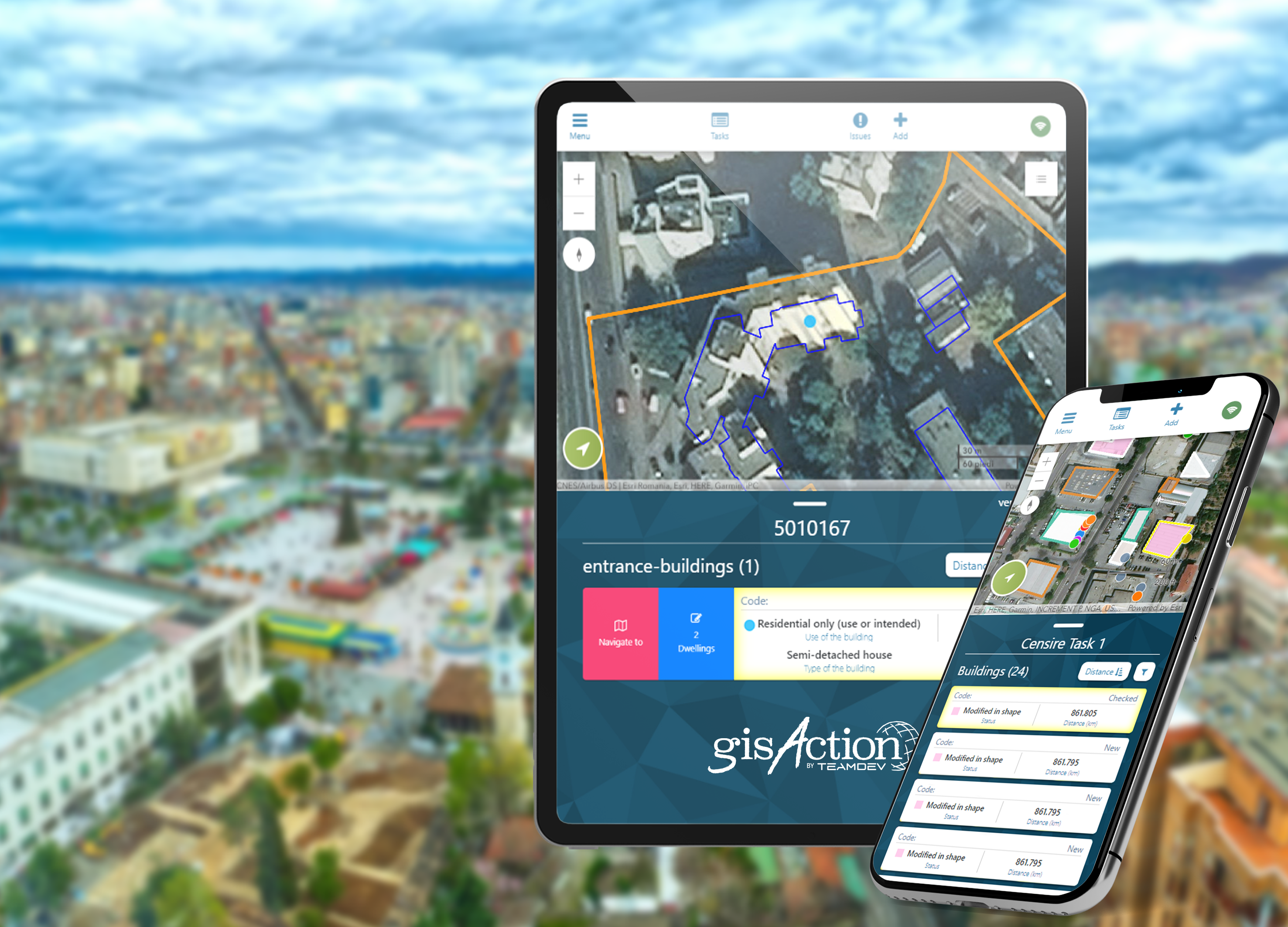
The first process applied aimed at building a versioned enterprise geodatabase concurrently accessible by several users. The geodatabase allowed to digitize boundaries of buildings and street lines in the entirely territory of Albania with high-resolution orthophoto base maps provided by the Albanian Government. The team developed customized software tools for the delineation of boundaries of census Enumeration Areas (EAs) and their coding, using semi-automatic procedures. This was possible through the development of an algorithm based on the physical morphology of the territory (ridges, slopes, streams), boundaries of administrative units, location and shape of roads, streets, and buildings.
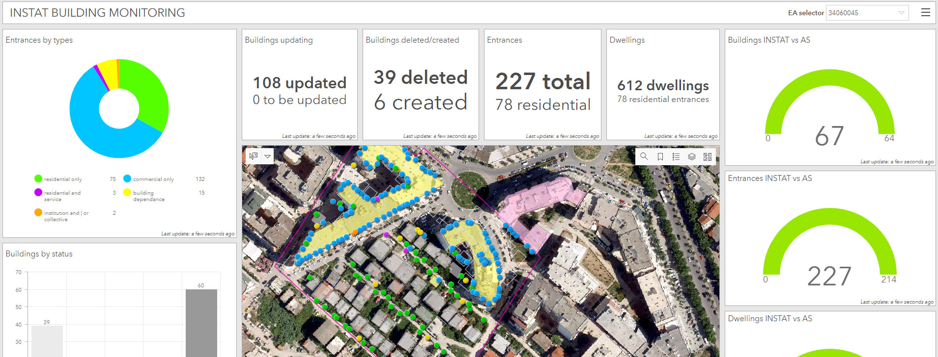
At the heart of gisAction’s work, then, was the development of an innovative application for real-time monitoring of the coverage of census operations: Easy Census. The number of interviews completed, number of households, persons and housing units enumerated were transmitted from the enumerators and supervisors via mobile sms to a GIS server located at the INSTAT headquarters and mapped with a web feature service. At any time, therefore, it was possible to monitor the progress of the census.
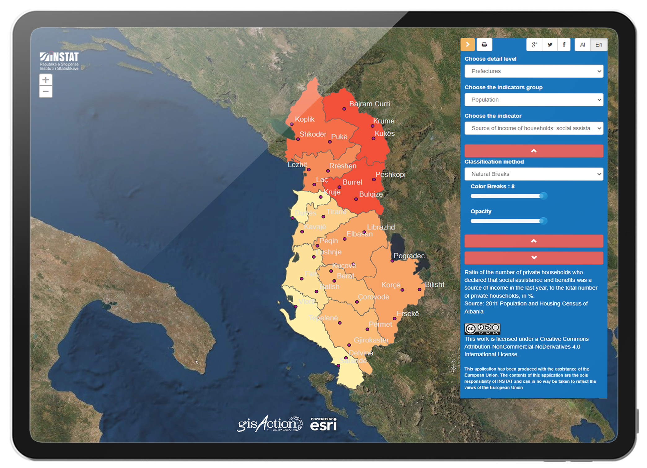
Finally, for the results dissemination phase, a navigable web app was developed for reading the census results and collected data. The app is published in English and Albanian and is accessible from desktops, smartphones and tablets at this address www.instatgis.gov.al

Benefits: innovate to optimize
With the implementation of the solutions offered by gisAction, INSTAT has been able to acquire data with greater simplicity and precision, has saved a significant amount of time and resources, has introduced innovative working tools allowing offline data collection, has equipped itself with dashboards for real-time monitoring and has increased the value of the data collected thanks to a greater use and dissemination capacity.