gisAction solution to support the cooperation project is an innovative Monitoring and Evaluation system, the Monitoring Information System.

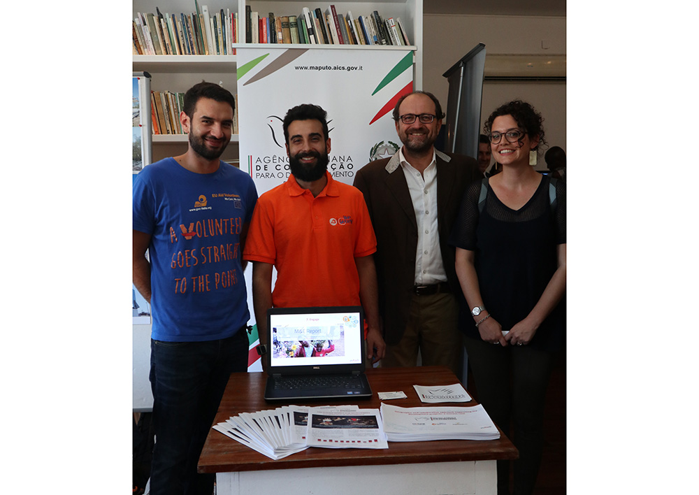
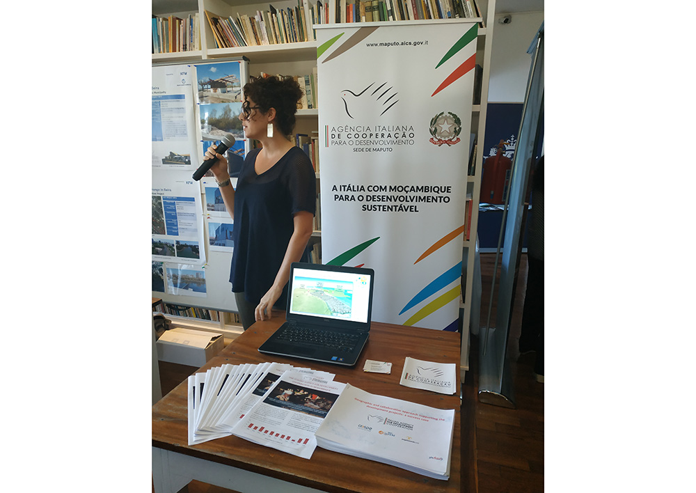
The Italian Agency for Development Cooperation (AICS) has entrusted COSPE and other partners with the project “Rural development in Mozambique and eSwatini” for the mitigation of the disastrous effects of drought. The contribution of gisAction for the project is the Monitoring Information System, a solution developed on a cloud platform that integrates the geographical dimension in the evaluation of data, digitizes the process and activates a connection between people, departments and organizations.
Needs: innovate the Monitoring and Evaluate process
The project “Rural development in Mozambique and eSwatini” is part of the program ” Mitigation of the effects of drought caused by El Niño in Southern African countries for strengthen the resilience of the beneficiary communities AID 10862″. The climatic phenomenon called El Niño causes a strong warming of the waters of the Pacific and generates severe flooding in the areas directly affected, but it also has dramatic effects in more distant areas: Mozambique and the Kingdom of eSwatini have been hit by a severe drought precisely because of the climatic phenomenon, and this has worsened the already emergency food crisis in the countries. The AICS project intervenes to mitigate the effects generated by El Niño and strengthen local communities.
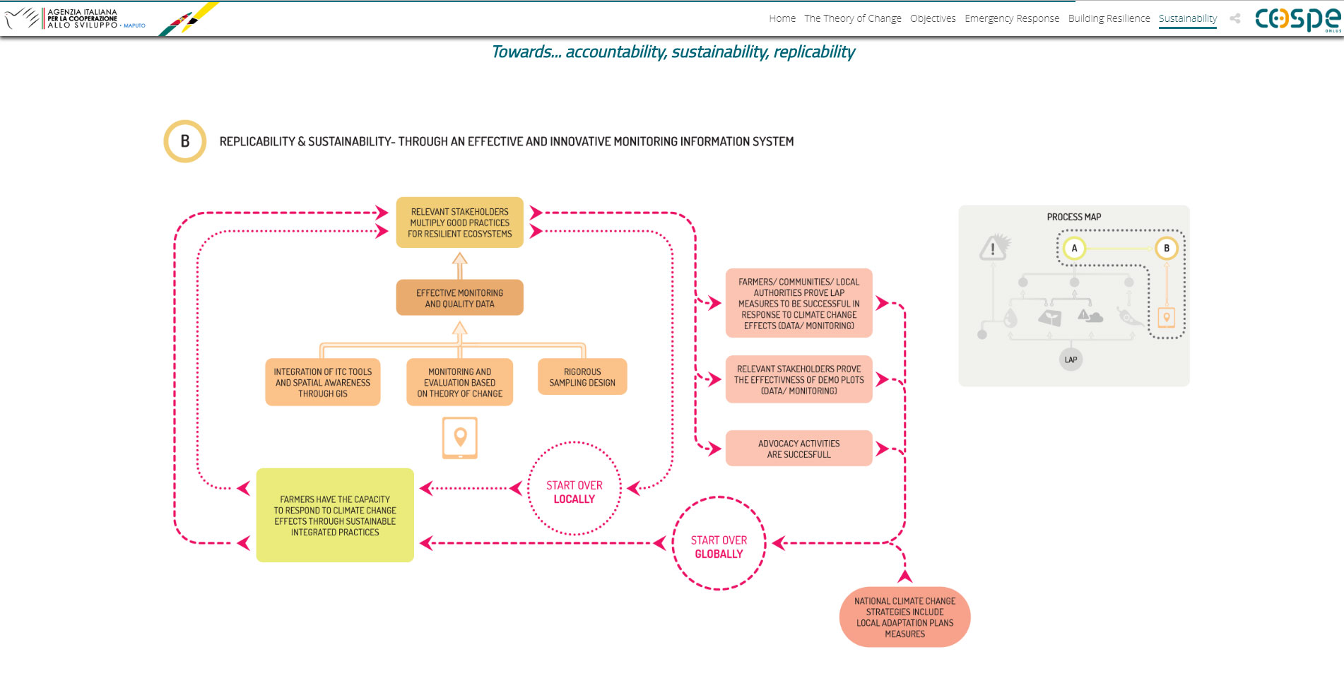
One of the goals of the project is to improve the collection and management of data to allow an overall control of the project activities. It introduces the necessary corrective measures and maintain a constant flow of information with the investor and the partner country administration.
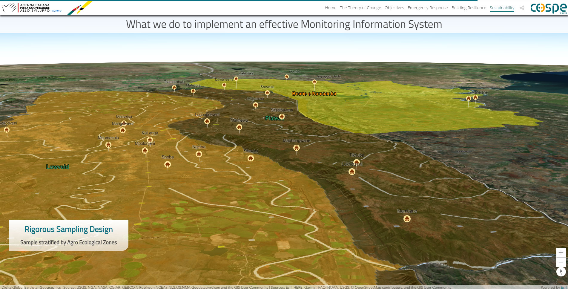
The instrument identified to achieve this result is the adoption of an advanced monitoring system (M&E) capable of measuring the indicators of achievement of expected results and of the objective and based on the use of vegetation indices from satellite images.
Solution: GIS technology
The configured system is a Geographic Information System (GIS) based on the open and interoperable technology of ESRI Inc., within the framework of the Nonprofit Program, which allows the integration of desktop, web and mobile tools, capable of geo-tuning traditional measurement tools, M&E study and evaluation.
GisAction is involved in the development of the mapping of the project, configuration and management of the WebGis, analysis of remote sensing data, configuration of the mobile app for the collection and analysis of field data.

Benefits: decision support, programming and dissemination
The configured WEB GIS system supports the monitoring and evaluation activities of the “Rural Development in Mozambique and eSwatini” project and is aimed at managing and returning the complexity of the intervention in the three years of implementation 2018-2020 in a visually simple and intuitive way.
The primary purpose of the system is to provide a set of integrated tools, ascribable to the domain of ICT, for the collection, management, analysis and visualization on a geographical basis of the data relating to the evolution of the context and the intervention. The availability of quality, up-to-date, geo-referenced data that allows for diachronic as well as spatial analysis will allow to support decisions to improve contextual execution and future planning.
Among the objectives there is also that of offering the opportunity to disseminate, promote and involve, through dynamic and interactive WEB applications, the project stakeholders: the sponsoring organizations, the financiers, the local, national and international partners, the beneficiaries, the general public.
Details: technology for the monitoring and evaluation system
Through the set of identified and configured tools, we act on three levels:
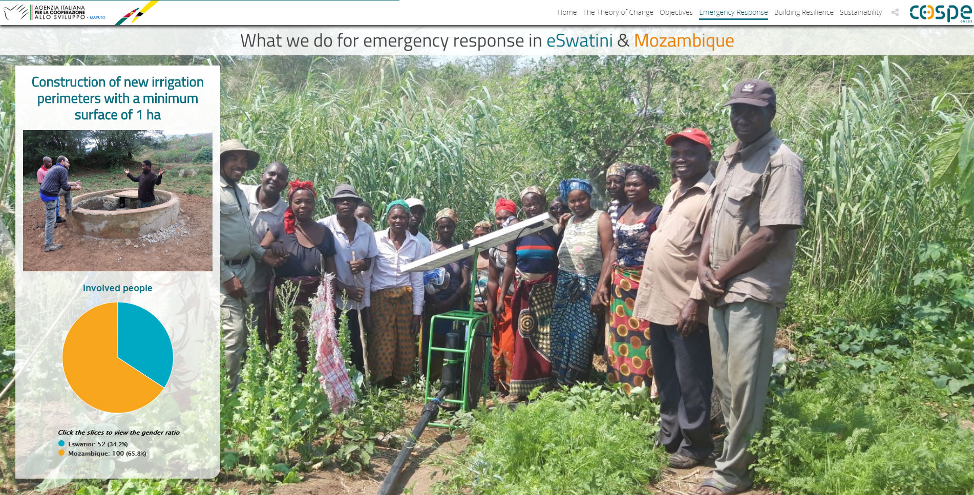
- First level – Field Data Collection: providing operators of mobile applications, easy to use, to collect data in the field. It is possible to collect geographic, quantitative and qualitative data, as well as audio and video attachments, available for all users of the platform, in near real time. Field applications can operate in either connected or disconnected mode;
- Second level – Web App Management: offer project managers a web map display, automatically updated, for daily control, planning and management of activities, both data collection in the field and those documented and manually integrated into the system. Provide information on “where”, “what”, “who”, and “when” facilitates project management according to the results-based approach.
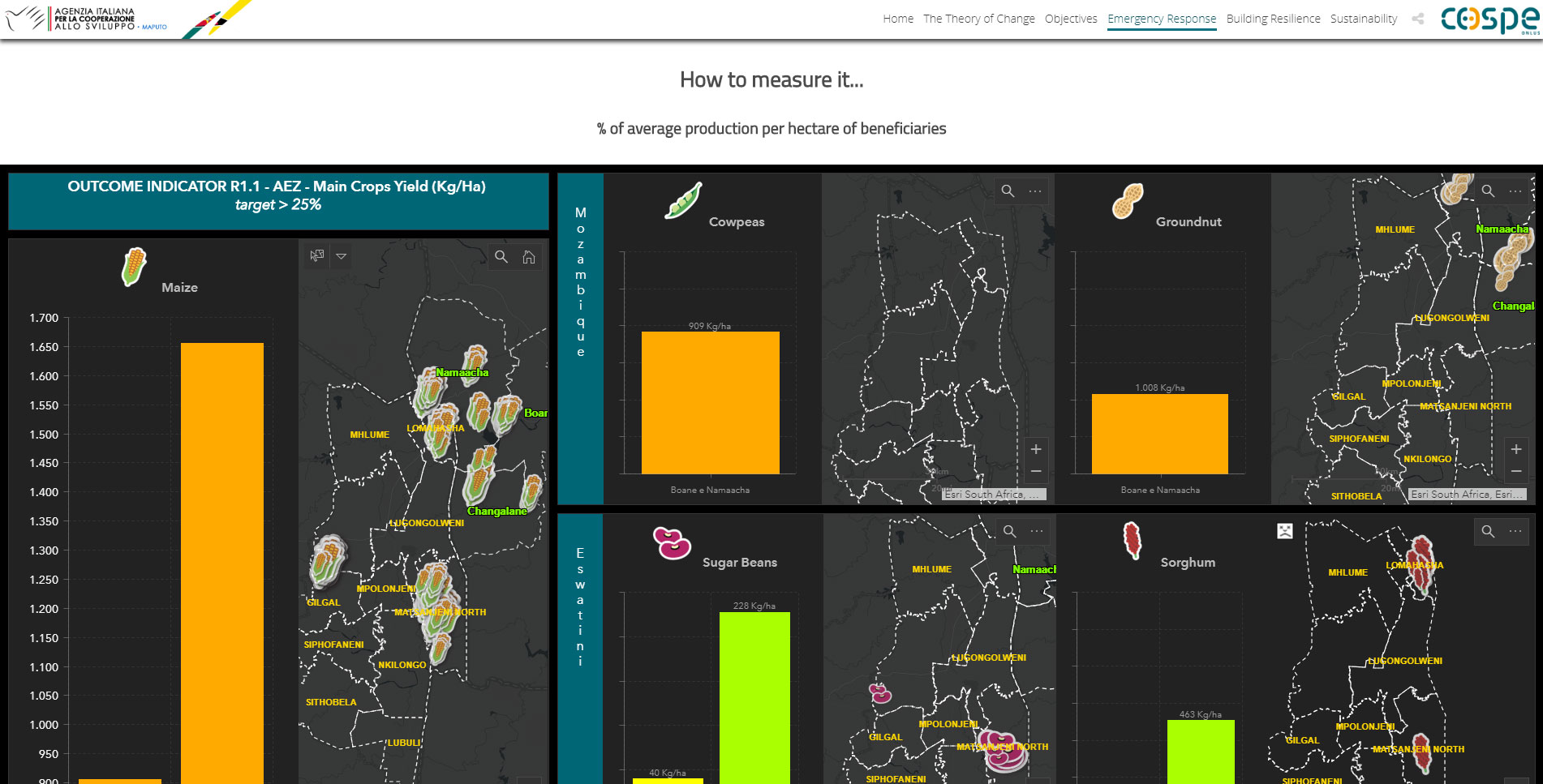
- Third level – Monitoring Web Dashboard: configure a synthetic visualization on a graphic and cartographic basis for the systematic examination of the progress, according to the POA and the Monitoring Plan, with verification of the progress of the objectives (outcomes) and products (outputs) and their respective indicators.
With the aim of measuring the set of project indicators, the system is able to integrate and return different types of data from different sources:
- Field data – synchronized in the cloud-based GIS platform (SaaS) automatically from mobile applications;
- NDVI elaborated from free multispectral satellite images (Landsat and Sentinel 2) – processed at Desktop level and published in the cloud based GIS platform (SaaS), in addition to the ready-to-use Imagery services, available in the cloud;
- Average NDVI profile, time series, of FAO GIEWS ASIS service (1984-2015) available at administrative level L1;
- Project documentary data, mostly tabular, which can be published and integrated into the cloud based GIS platform (SaaS).
Notes

Who we worked with
COSPE was founded in 1983 and is a private, secular and non-profit association. It operates in 25 countries around the world with around 70 projects alongside thousands of women and men for a change that ensures fair and sustainable development, respect for human rights, peace and justice among peoples.