Technical support and GIS Analysis of Spatial Data
Decision Support System | “Hot Spots System”

Project for Arpa Umbria
The Regional Environmental Protection Agency (ARPA) was founded in Umbria on 6 March 1998. It has a regional structure with public legal entity, technical-administrative autonomy, and is subjected to the supervision of the Regional Council.
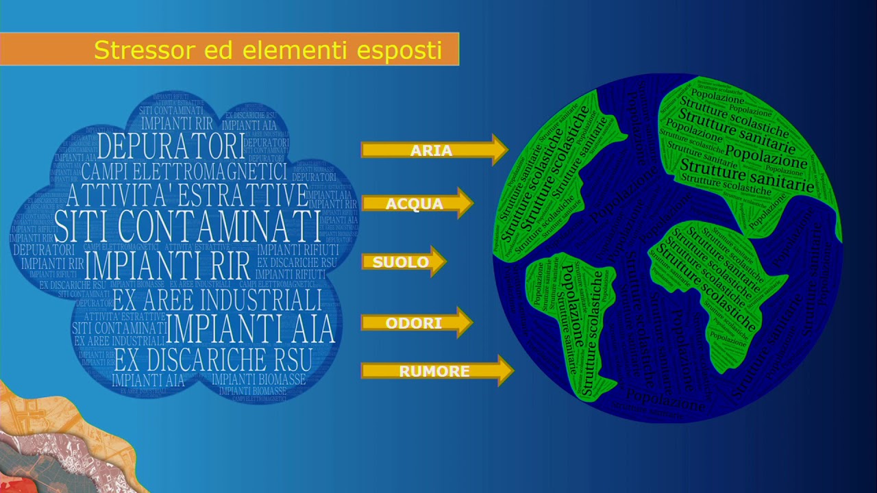
The agency’s activities range are connected to controlling pollution factors, monitoring network management, controlling air, water and soil quality, waste, radiation and noise, large industrial risks. The agency has also the task to create and manage the information systems and environmental databases.
Customer needs
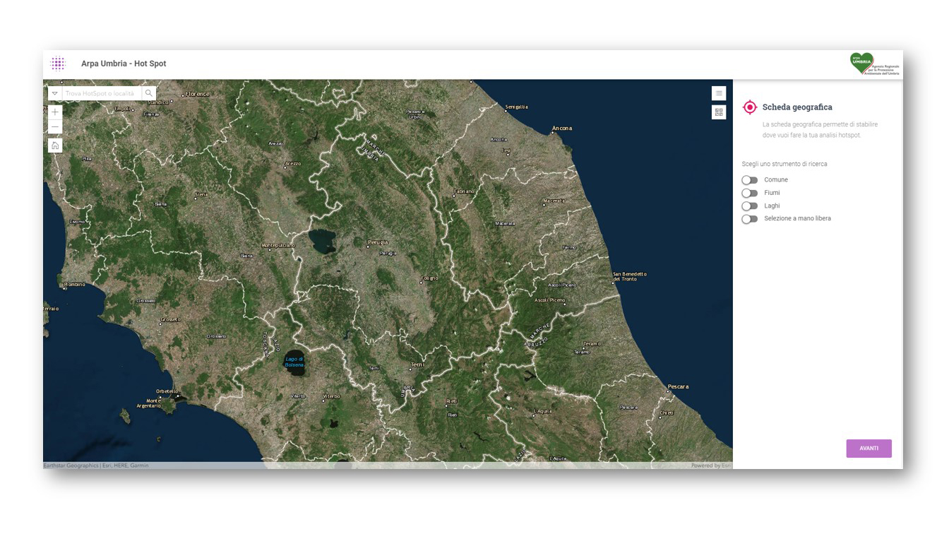
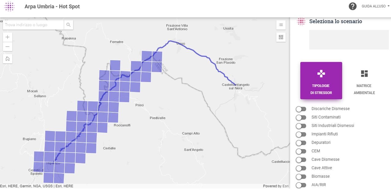
ARPA Umbria has expressed the requirement to acquire a Decision Support System called “Hot Spots System”.
The dss, in the form of a WebGIS application, aims to support the agency’s structures in implementing activities with a view to optimizing environmental knowledge, their availability and usage through operational tools and methodologies that facilitate the task of its own officials and technicians. This improvement has the perspective to support the interventions in the various decision-making areas.
The platform has the purpose to optimize the processes of analysis and assessment of environmental impacts. It is also able to support planning, programming, design and control of the decisions. The aim is to concretely pursue sustainability-oriented actions.
Solution: Story map for disseminating information
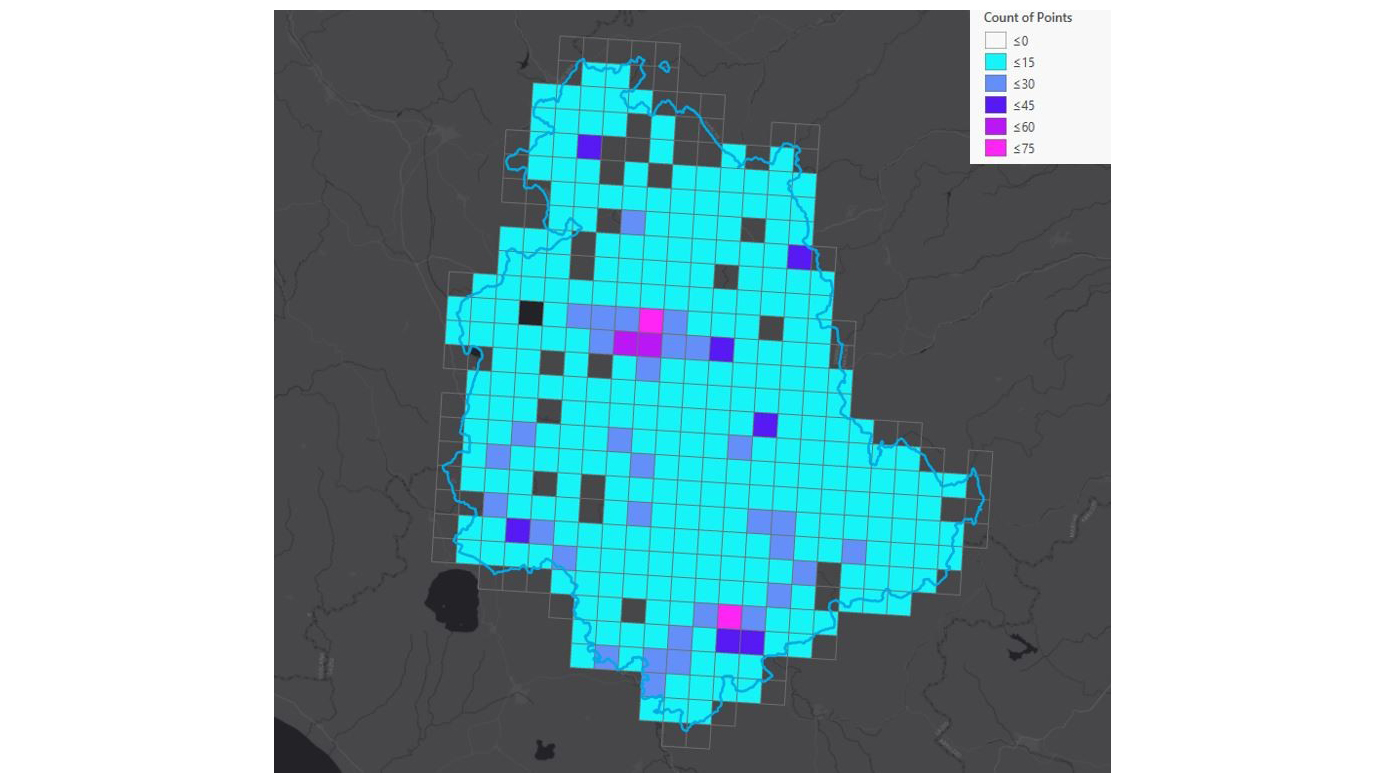
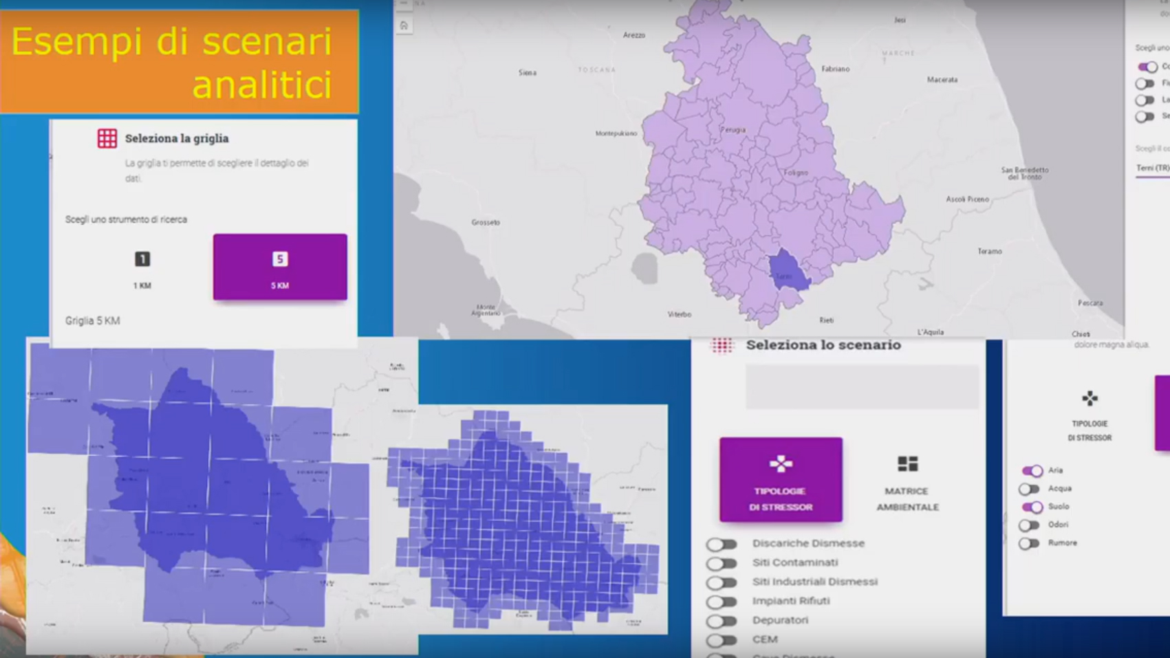
gisAction has performed evaluation and analysis tests of the data provided by ARPA Umbria. It has also provided the most suitable operational methodology for the creation of a platform in order to facilitate the immediate visualization of critical issues in the managed area. The tool became a concrete support for decision-making activities related to the impacts on the environmental matrix and on other elements controlled by ARPA Agency
Benefits of the Story map
The analysis methodology and visualization techniques allowed ARPA Umbria to take advantage and improve the management of the large amount of environmental data in its possession.
The applied methodology was fundamental for the implementation of the WebGIS “Hot Spot System” application.