The “Rigenera” project, financed by the Italian Cooperation Agency and implemented by a consortium of NGOs, of which AVSI Foundation is the lead partner, deals with the integrated and participatory redevelopment of the Chamanculo C neighborhood, in Maputo, with infrastructural works and socioeconomic promotion of the neighborhood’s population. Co-design and Development of a Digital and Geographic Monitoring System to support operational and strategic decisions – Monitoring Information System.
Context
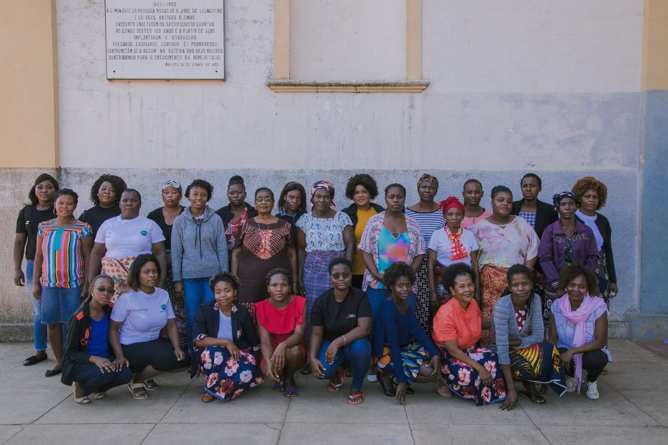
The Chamanculo C Bairro is located in the Nhamankulu Municipal district and is inhabited by approximately 28,000 people, mostly young (55%) and women (51.3%). The neighborhood has developed according to a disorderly and unplanned urban structure, it is densely populated and characterized by poor accessibility to basic services (food, water, sewage system), lack of fundamental land use rights, and a high poverty rate.

AVSI Foundation and Partners involved
AVSI Foundation is an Italian NGO founded in 1972, currently operating in 32 countries worldwide in the areas of Education, Urban Planning, Energy, Agriculture and Food Security, and Vocational Training.
In Mozambique, AVSI has been recognized since 2010 and is currently implementing 15 projects in the provinces of Maputo, Cado Delgado, Sofala, and Zambesia.
Currently, it manages three projects on the urban theme: “Rigenera”, “Decor”, and “Partecipade”. These are three projects aimed at enhancing and regenerating the urban area through the development of educational, social, and cultural components, the inclusion of services, and territorial reorganization in informal neighborhoods in the cities of Maputo and Pemba.
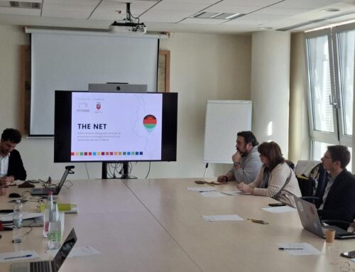
Since 2020, AVSI Foundation in partnership with Khandlelo, Cospe Onlus, ASf, E35, Municipality of Milan, and the Municipal Council of Maputo have been collaborating for an integrated, inclusive, and participatory development of Chamanculo C, thanks to the “Rigenera” project funded by the Italian Agency for Development Cooperation (AICS).
GIS in urban planning projects
AVSI uses the GIS tool in its territorial planning and urban regeneration projects carried out with a specific participatory and integrated methodology that is based on KNOWLEDGE OF THE TERRITORY, PLANNING, AND IMPACT ASSESSMENT. Territorial planning involves the development of urban plans, while urban regeneration involves the functional reconfiguration of a place.
GIS is used in all phases of the methodology:
- Knowledge of the Territory
- Planning
- Impact measurment
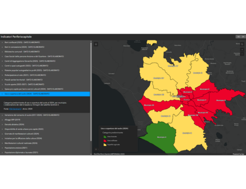
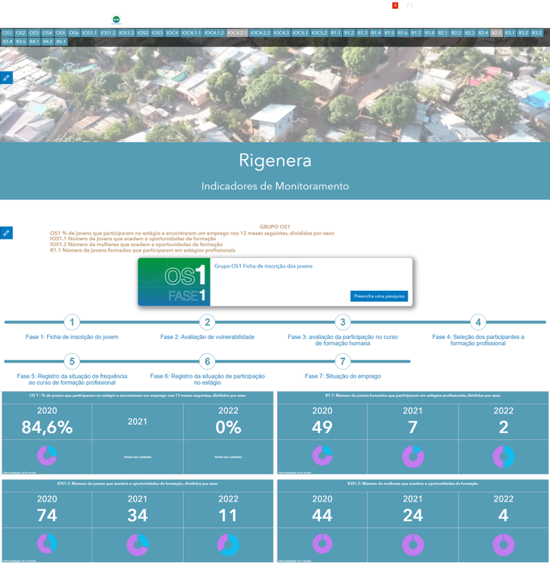
For the “Rigenera” project, GIS is used to monitor the project’s evolution and achievement of its goals through constant monitoring of indicators. This has resulted in the creation of an online digital mapping platform that displays the project’s progress in real-time, serving as a decision-support tool for the Municipality and local associations in making decisions about the project and urban policies.
Needs
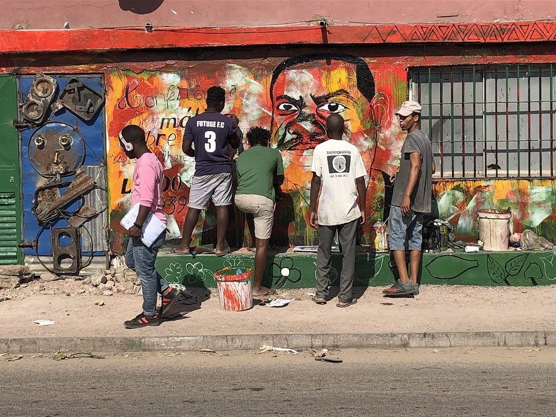
The project, heavily focused towards women and young people, aims to “regenerate” one of the oldest neighborhoods in the capital of Mozambique, involving the community and its representatives (associations, universities, local authorities) to promote inclusivity, resilience, socio-economic development, and environmental conservation.
Among the objectives set by AVSI for this project, gisAction answered the need to create a digital and interactive cartographic monitoring tool, which allows online tracking of the main activities carried out by operators in the field and monitoring of project key performance indicators (KPI).
The “Rigenera” project has the need of monitoring actions aimed at strengthening the social, economic, cultural, and environmental context of the neighborhood, its safety and accessibility, mainly by introducing new services to the area and enhancing its infrastructure. The project also has the need to have tools to operate on opening roads and supporting the role of women in the development of the territory.

Solution
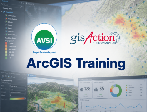
Our work has involved co-designing with our partners and implementing a Monitoring Information System, including training on ArcGIS Online.
- Data is collected through two field applications, ArcGIS Survey123, using easy-to-use questionnaires, and ArcGIS FieldMaps, for pinpoint and rapid collection of information directly on a map.
- Data is then displayed on Operational Dashboards, for monitoring the KPIs defined during the co-design phase of the monitoring system.
- An ArcGIS Hub collects all the KPIs for an effective overview of the entire project from a technical standpoint, with the ability to access all the Operational Dashboards of individual indicators.

In addition, we are collaborating on the creation of a StoryMap to describe the ambitious and complex work of participatory and integrated regeneration of the Bairro.
Benefits
The main benefits of the configured solutions consist in supporting:
- Efficient and accurate data collection through field applications, allowing for rapid acquisition of information and increased accuracy in data recording.
- Real-time monitoring of project KPIs, allowing for informed decision-making and timely intervention to address any issues.
- Providing clear data visualization and concise visual analysis of collected information and project progress
- Sharing of results through appealing storytelling tools, allowing for effective communication of the work done to various players and the community.
The data collected so far is encouraging and shows active engagement from the population. These tools not only support technological innovation but can directly support the social and economic development of communities that require “regeneration” process that starts upwards from the ground.

AVSI has leveraged the power of ArcGIS Online and its suite of tools to streamline its territorial analysis process by digitalizing data collection. This has eliminated the need for paper maps and instead, data is collected through digital applications, which can be directly sent to the platform. By doing so, AVSI has been able to eliminate many errors that are associated with manual data transmission while also creating a more unified work environment.
Questionnaires that are uploaded onto the platform can now be administered through a phone or tablet, and the data collected is then automatically sent to and archived on the platform. This has enabled AVSI to work in a more organized, fast, and precise manner while also providing real-time monitoring capabilities for the project. As a result, the work has become more efficient, and AVSI has been able to achieve its goals in a more timely and effective manner.
Thanks to the use of ArcGIS Online and its AVSI tools, it was possible to link all the stages of territorial analysis by digitizing data collection, which is no longer carried out on paper maps, but through digital applications that directly send the data to the platform. This eliminates many errors in manual transmission of data and fragmentation of working environments and information. Data is directly retrieved through questionnaires uploaded to the platform and administered via phone or tablet, which are sent and stored directly in the platform.
The work is thus more organized, fast and precise, with the possibility of monitoring the results of activities and the project in real-time.
Who we worked with
AVSI bases its cooperation projects in various sectors on a preferential focus on education, understood as accompanying individuals in the discovery of oneself and recognizing others as a valuable asset.
Each project is therefore conceived as a tool aimed at promoting this awareness in all those involved, it has a need for communication and sharing within it, and exercises an impact capable of generating positive change.