Two StoryMaps have been created: the first to present the Association GAL Media Valle del Tevere Association in an effective and engaging way, the second as a tool for the dissemination of information on projects aimed at promoting the local development of the area related to Tiber river.
Customer
The client GAL Media Valle del Tevere is a Local Action Group officially created on September 14th 1994. It is an Association, aimed at promoting the local development of the area relating to the middle course of the Tiber River.
It operates in 13 municipalities of the Perugia Province and in 2 of Terni. (Learn more)
Customer needs: give visibility to its activities
The GAL is a very active entity in Umbria, but not well known yet. For this reason, the intention is to give visibility to its activities, purposes and projects implemented through a dissemination tool on the web that clearly explains the aims and what was actually achieved.
Two products were requested:
- one for the description of the organization, to be also used during conferences and events presentations,
- the second dedicated to the achieved aims and interventions for the implementation of its 2014-2020 Local Action Plan.
Solution
gisAction proposed the StoryMap as a tool for disseminating information, besides the website. This tool, in fact, allows to expose the communication more clearly, and gives the possibility to the users to interact with the contents, to browse through images, geographical maps, and graphics.
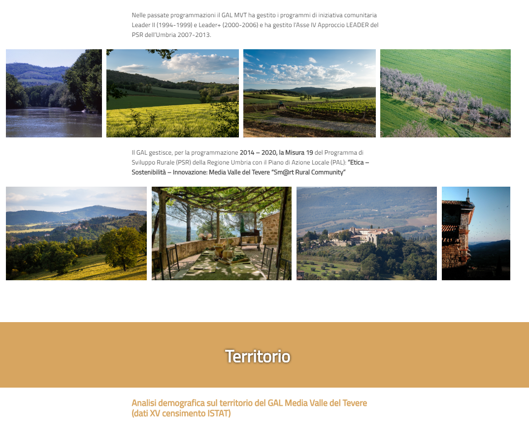
The geographic maps offer an added value to the reading of the territorial indicators and allow to move on the territory to perceive the local differences and trends. In the storymaps are also available beautiful videos that tell about aspects of the territory such as history, eno-gastronomy, culture.
The descriptive StoryMap of the GAL Media Valle del Tevere
The descriptive StoryMap of the Association was created using the ESRI Cascade template, excellent for descriptive and narrative purposes.
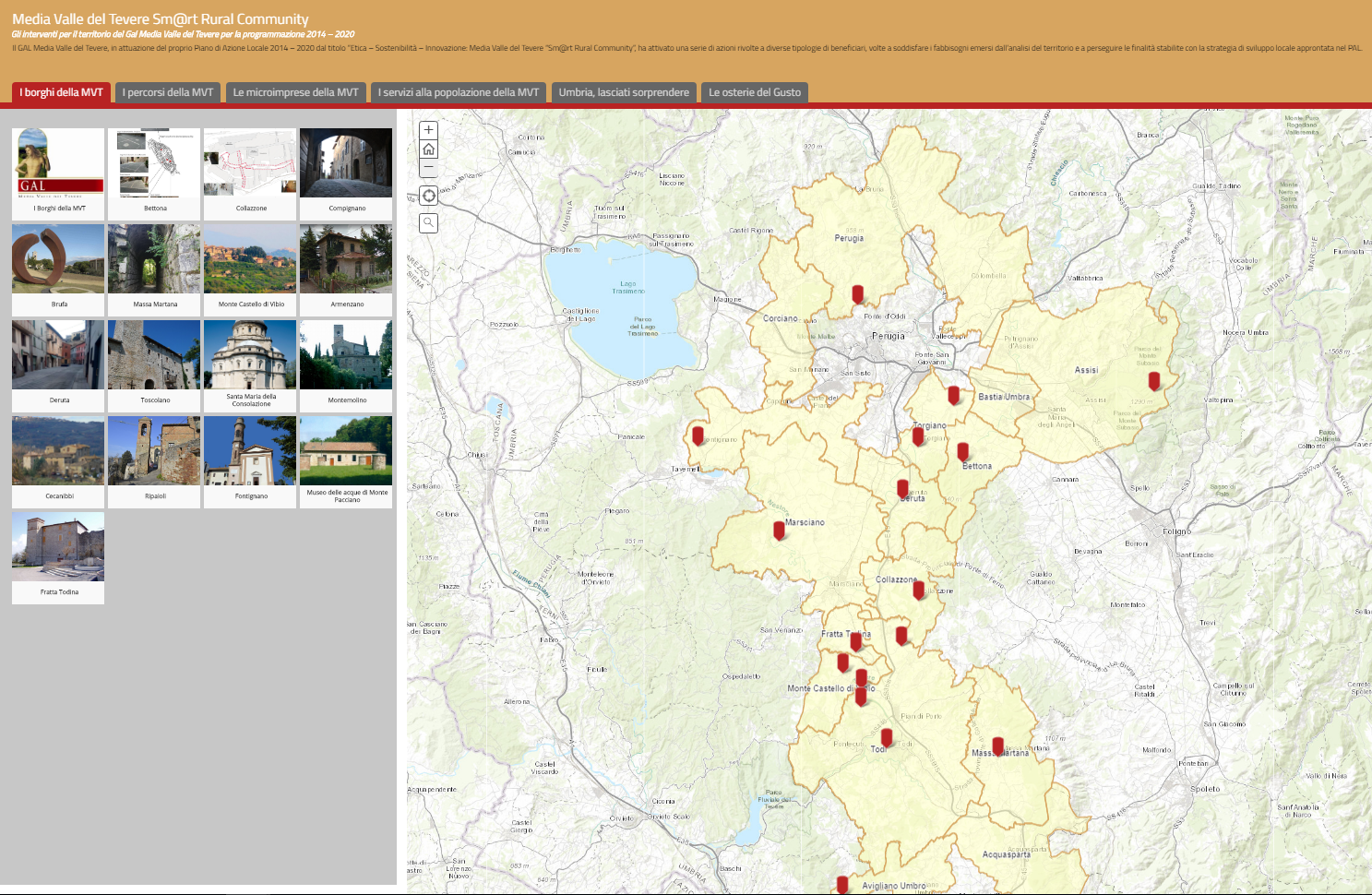
The StoryMap related to the projects
The StoryMap related to the interventions was realized using the ESRI Shortlist template. This template allows to collect the various projects in sections corresponding to the action themes: “The hamlets”, “The pathways”, “The micro-businesses”, “The services for the population”, “Umbria let yourself be surprised” and “The Taverns of taste” . All the interventions are localized and accompanied by images and description. Both storymaps have been customized making improvements to the graphics coordinated with the GAL website.
Benefits
The StoryMap is easily accessible and can be shared on web. The geographic maps contribute to show clearly the territory where the GAL and its main indicators act. Large narrative texts, images and videos allow us to catch the eye.