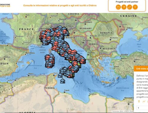
Geographic platform for data sharing system and tools for the visualization of PTCP dataset – Provincial Coordination Territorial Plan.

The system allows an exchange of information between the Province of Perugia and other stakeholders, such as municipalities, professionals, citizens. The project has been realized on the ESRI ArcGIS Online platform already provided by the Province of Perugia to obtain a simple, collaborative and participative system.
The platform consists of the following main sections:
- Container for storing, creating and managing geographic contents representing PTCP themes;
- OpenData platform for sharing geographic layers and any other material related to the PTCP;
- WebGIS application for the visualization of PTCP themes, data querying, constraints querying, support for the intervisibility study and printing of reports and maps.
Project realized for the Province of Perugia
The Province of Perugia is a local territorial authority of Umbria that has competences in the field of environment and territory, construction, road network and other services. We worked for the Service “Road design, planning, expropriations and state property”, Office “Territory and Planning”. The Office is responsible for the management and updating of the Provincial Coordination Territorial Plan, in collaboration with the other technical offices and the information systems of the Authority, of the Region and of the Municipalities; to this end, it designs, develops and updates, within the internet network, webgis and systems of diffusion and consultation of the cartographic and thematic database. For years the office has been working with geographical data for the realization of thematic maps.
Needs: easy data management, visualization and sharing
The Public Administration has a growing need to incorporate and make available DATA: the institutions have responsibility for the function they perform (issuance of permits, opinions, etc.) and therefore need reliable data, updated and usable in real time, and that describe the reality in an appropriate and timely manner.
The tools required by administrations to meet this need must, however, be characterized by simplicity of access and simplicity of use.
The need of the Province of Perugia was to improve workflows both in the management of PTCP data within its own Offices and Services, and in the processing of documents involving subjects external to the Province, such as Municipalities, technicians and professionals from the private sector, citizens.
Some workflows were identified for which it was necessary to improve the approach to data, its sharing and availability. For example the exchange of data for the drafting of the Municipal Master Plan, the transition of the Master Plan from Structural to Operational Part, the visualization of data during the Simplified Services Conference, the planning of emergencies, the evaluation of constraints in an area.
These needs drove the development of a cross-cutting, multi-user platform.
Solution: an innovative web platform

A web platform has been designed and implemented, using ArcGIS Online for the storage, creation and sharing of geographical layers and other material related to the PTCP.
The platform can be divided into three main blocks:
- Container for storing, creating, and managing geographic content representing PTCP themes. It is the ArcGIS Online platform itself that represents the data repository and allows selective access and well-defined roles based on staff expertise.
- OpenData platform for sharing geographic layers and any other material related to the PTCP. Realized through the ArcGIS Hub, it allows the sharing of data with external users. The data can be consulted and downloaded.
- WebGIS application for visualizing PTCP themes, querying data, querying constraints, supporting the intervisibility study and printing reports and maps. Realized through ESRI’s Web AppBuilder, it contributes to more efficient workflows.
The project was therefore realized by exploiting the potential of the ESRI ArcGIS Online platform already in the possession of the Province of Perugia to obtain a simple, collaborative and participatory system. A system that allows both the active participation of other territorial entities in the construction and sharing of information and data, and collaboration on administrative processes in which the software ecosystem acts as a storage system and decision support.
Benefits

There will be benefits in terms of efficiency in the daily workflows that see engaged more Services/Offices of the Province of Perugia and the different municipalities of the territory.
The platform, in fact, will allow to make more efficient the collaboration and the passage of geographical material related to the PTCP both among the various Services/Offices of the Province of Perugia, and between them and the municipalities. The workflows based on the exchange of geographical material between the Province and the requesting administrations will be improved. The platform will allow to:
- Have a single repository of geographic data related to the PTCP
- Remotely share geographical data related to the PTCP with those who request it
- Query autonomously the PTCP constraints
- Visualize PTCP themes on the territory
- Print maps containing PTCP themes
- Elaborate simple maps and applications for the analysis of themes
Who we worked with