Risk Map for Ukraine cultural heritage: A data-driven approach to conservation Risk Map – Ukrainian cultural heritage

On January 23, 2025, ICCROM launched the Risk Map – Cultural Heritage Ukraine, an interactive platform designed to assess and mitigate risks to war-affected cultural heritage sites. The initiative, part of the Cultural Heritage First Aid and Resilience in Times of Crisis (FAR) Program, provides a systematic, data-driven method for assessing damage, identifying vulnerabilities, and supporting recovery planning.
What does the Risk Map do? Cultural Heritage Ukraine?
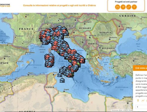
- Maps over 250 cultural heritage sites in nine Ukrainian regions.
- Assesses various threats to cultural heritage sites and damages, including those resulting from ongoing conflicts and environmental factors.
- Helps prioritize resources for emergency response and long-term recovery by identifying the most vulnerable sites. In this way, the map supports in the effective allocation of resources for immediate and future conservation works.


Caratteristiche principali della Risk Map- Main features of the Risk Map-Cultural Heritage Ukraine
- Comprehensive risk analysis: The map offers in-depth assessments of the various threats facing cultural heritage sites, including conflict-related damage and environmental factors.
- Interactive visualizations: Users can explore detailed visualizations that highlight the vulnerability levels of different sites, helping to identify priority areas for action.
- Data-driven decision making: By providing systematic risk analysis, the map supports evidence-based strategies for emergency response, risk reduction, and post-conflict recovery efforts.
Methodology behind the Risk Map
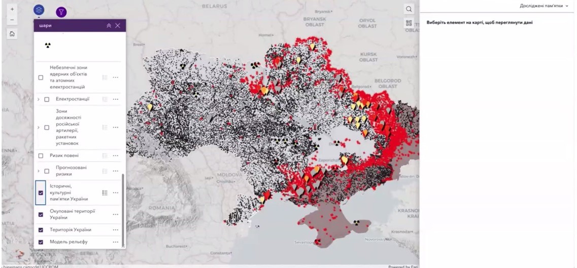
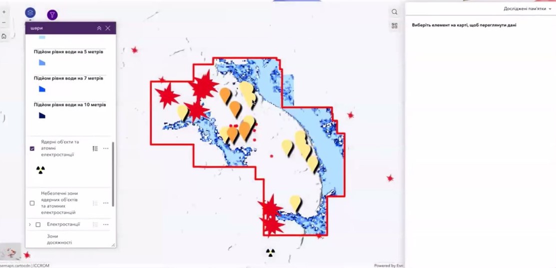
The development of the Risk Map used meticulous methodology to ensure accurate and reliable assessments. Data were collected from various sources, including field reports, satellite images, and historical documents. This information was then analyzed using geographic information systems (GIS) to map heritage sites and assess their vulnerability to various hazards. Factors such as proximity to conflict zones, environmental conditions, and historical significance of the sites were considered in the analysis. The methodology page provides a detailed overview of the processes and criteria used in the assessment.
Resources for further information
For those interested in learning more about the Risk Map, several resources are available. The resources page provides access to detailed reports, data sets, and additional tools that complement the Risk Map. These aids provide insights into cultural heritage sites, identified risks, and proposed strategies for their preservation. Users can also find guidelines on how to effectively use the Risk Map for research, planning and intervention purposes.
The role of gisAction
gisAction contributed to the development of the Risk Map, supporting the data visualization and mapping process. Their expertise helped transform the collected data into an accessible and interactive tool that guides decision makers, heritage professionals, and humanitarian organizations.
Why is it important?
With continued threats to cultural sites, the use of GIS technology ensures that recovery efforts are efficient and targeted. GIS tools not only aid in immediate response, but also lay the foundation for long-term heritage protection and planning.