Social mapping is increasingly being used to understand the distribution of organizations, services, and communities in urban settings. By integrating spatial data with digital mapping, it is possible to provide a clearer picture of local conditions and improve access to geographic information. A recent project developed for the Fondazione Charlemagne involved mapping the associations supported by the foundation through the Periferiacapitale program and visualizing sociodemographic datasets related to the City of Rome using GIS applications and web-based geographic tools.
Mapping Local Organizations in Rome
The project initially focused on updating an online map dedicated to the associations supported by the foundation in the Rome area. The existing system was already integrated into the client’s Periferiacapitale program website, but managing and updating the information required a more structured workflow.
Using GIS and social mapping technologies, the database of associations was analyzed, reorganized, published, and revised in accordance with the graphic guidelines provided by the foundation. The new cartographic interface was then integrated into a web application embedded directly into the site via an iframe.
This approach allows users to explore organizations directly on the map and gain a better understanding of their presence in different parts of the city.
GIS Applications and Data Management
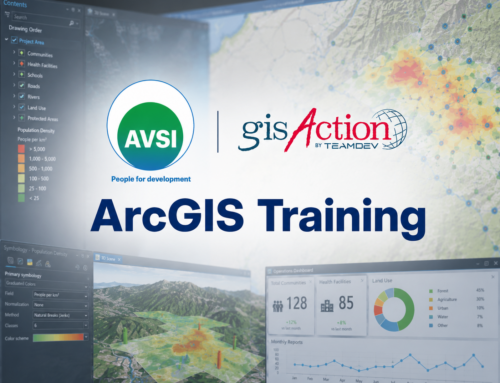
Several GIS applications were configured as part of the project to support both geographic visualization and the management of spatial data. The workflow included the configuration of an ArcGIS Online subscription used for publishing databases and managing geographic content.
To improve online access, an ArcGIS Instant Apps-based application was also developed for map navigation and the geographical exploration of data through social mapping. The application was configured according to the client’s visual guidelines, with a particular focus on ease of use.
An editing application was also set up to allow for the independent updating of the association database. Using this tool, the client can directly manage information related to the organizations without the need for ongoing technical support. Training sessions on data maintenance and editing were also provided.
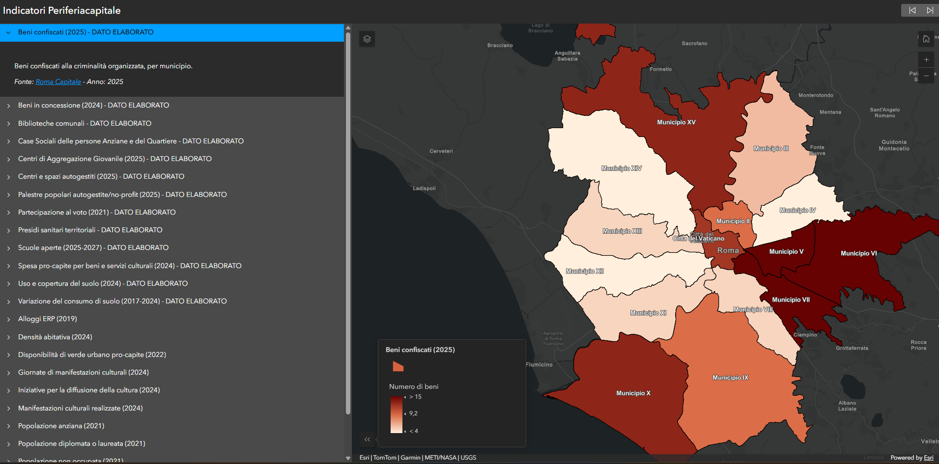
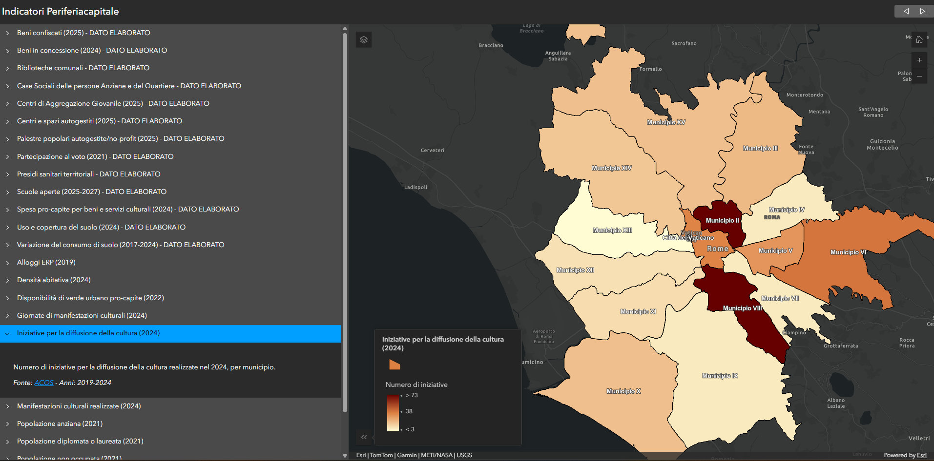
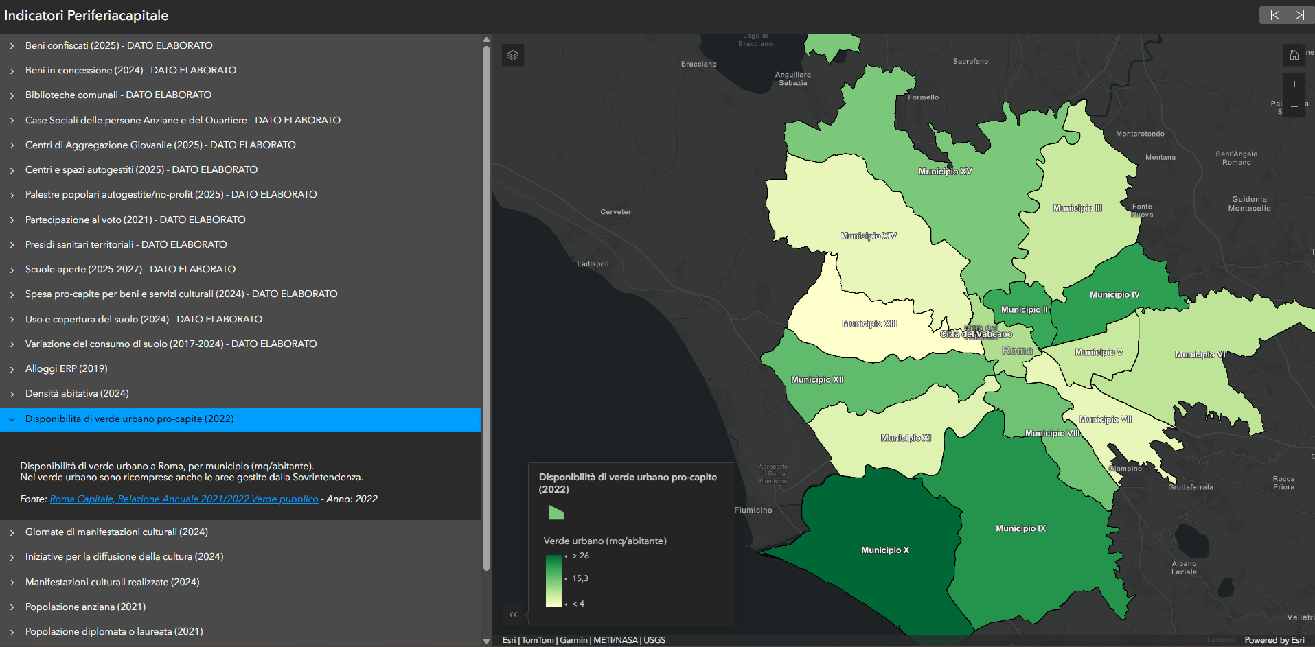
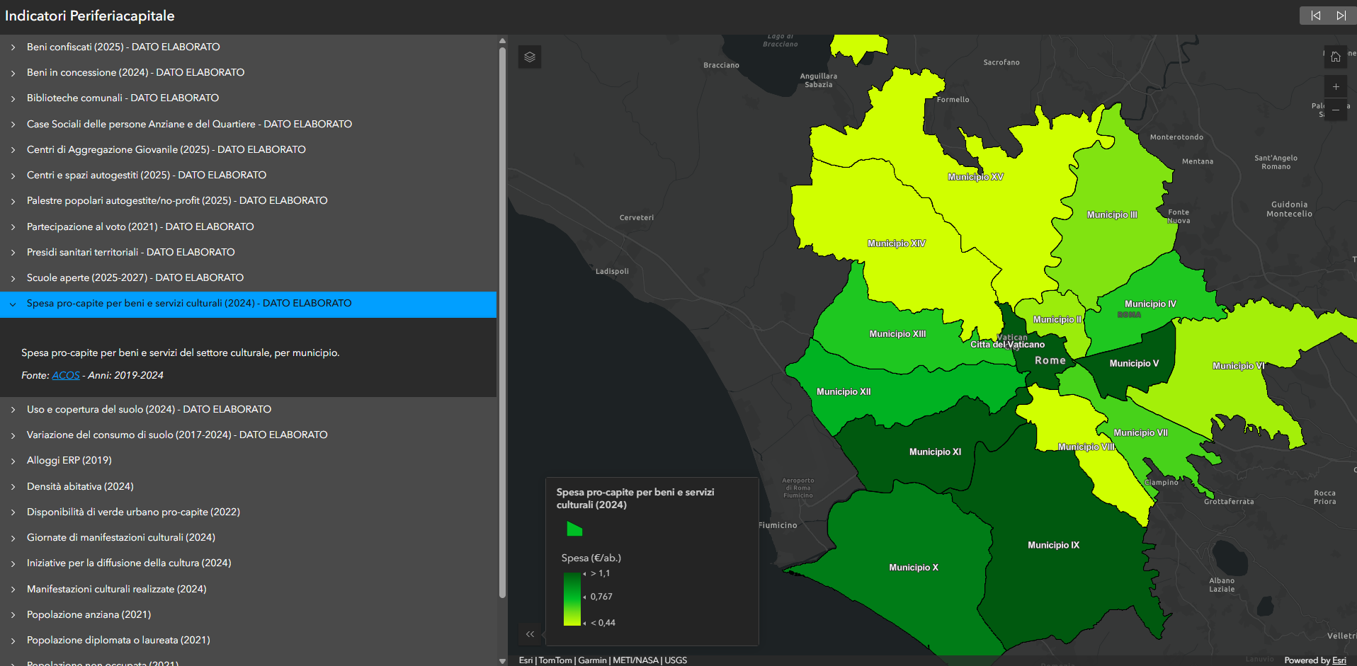
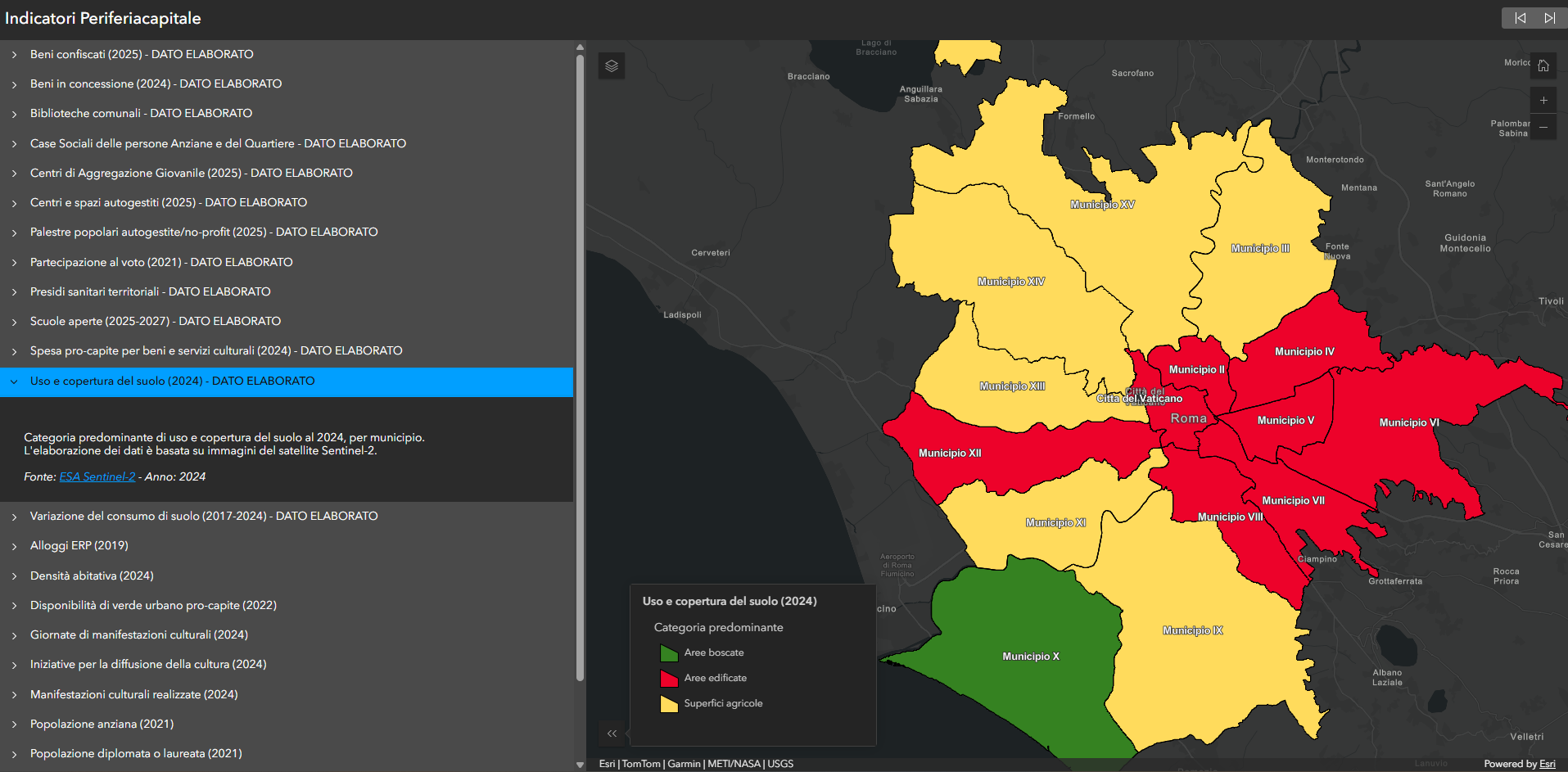
Socio-demographic visualization and spatial analysis
A second part of the project involved mapping sociodemographic indicators for the City of Rome. After selecting the most relevant datasets, the information was collected, processed, published, and transformed into geographic layers that can be viewed using interactive mapping tools.
Two separate applications have been developed to aid in the interpretation of the data. The first is a web-based atlas designed for map viewing. The second is an ArcGIS Dashboard that integrates maps, charts, and statistical indicators into a single interface.
The integration of demographic datasets with geographic visualization tools has made it possible to analyze urban indicators from a more spatially contextualized perspective.
GIS and Interactive Geographic Narrative
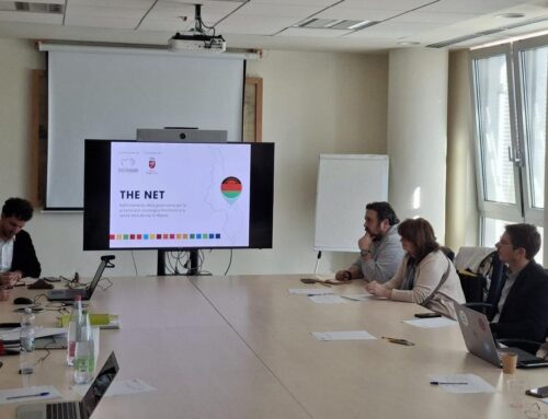
The project also included training sessions on ArcGIS StoryMaps, a platform used to combine maps, text, and multimedia content within interactive geographic narratives. These sessions supported the independent creation of communication content and the management of territorial narratives through GIS tools and social mapping.
The project integrated association mapping, demographic datasets, and GIS applications to create a structured geographic representation of territorial information related to the city of Rome. Using ArcGIS Online, Instant Apps, Dashboards, and StoryMaps, the initiative supported both spatial analysis and self-managed data handling.
Who we worked with
Periferiacapitale is a program of the Fondazione Charlemagne dedicated to Rome that supports projects in the city’s suburbs and most vulnerable neighborhoods. It promotes social inclusion, culture, environmental protection, and civic engagement by supporting local organizations and community initiatives.