A solution for remote monitoring of construction sites developed by gisAction for Comoé National Park.
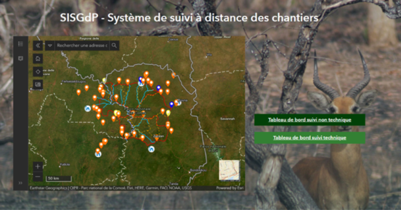
Comoé National Park is the largest protected area in West Africa, a biosphere reserve, and a UNESCO World Heritage Site. Since 2003, it has been listed as a World Heritage Site in danger, primarily due to increased poaching following the outbreak of the first Ivorian civil war and the subsequent disruption of management and monitoring activities in the area. Today, the Ivorian Office of Parks and Reserves (OIPR) has resumed its work in Comoé National Park, undertaking activities to protect park resources and promote regional development. GisAction collaborates with the park management; click here to read the story of our commitment and explore the interactive StoryMap.
Needs: Remote monitoring of construction sites in the park
The high number of construction sites in the park area made it necessary to implement remote monitoring of projects through the activation of a suitable tool capable of transmitting information in near-real-time. The ultimate goal was to provide the park with an advanced digital tool that could:
- Collect field data and transmit it in near-real-time to the platform.
- Aggregate data and effectively represent information and construction site performance indicators.
- Have a level of complexity such that a technician could immediately recognize critical issues in the state of work and provide a non-technical overview of the work.
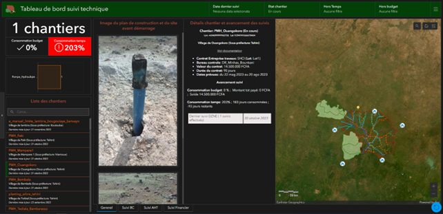
Solution: A complete and integrated monitoring system
The solution provided by gisAction consists of modules for data collection, monitoring, and decision-making for various profiles involved in the project:
- A data collection tool developed with ArcGIS Survey123, used by OIPR patrol agents, AHT technicians, and “Bureau de Controle” technicians to send data, photos, and comments on the state of work.
- Two data aggregation dashboards, one for technicians and one for non-technical users. The technical dashboard presents information collected by AHT and Bureau de Controle technicians, while the non-technical dashboard gathers information from OIPR agents.
- A data hub created through ArcGIS Hub that centralizes monitoring solutions and provides access to a repository of documents uploaded by AHT technicians.
These tools allow four different types of actors to remotely monitor field resources and the state of work, each according to specific informational needs. The system enables the Donor’s team, the Project Manager, the Infrastructure Manager, and the Park Director to be aware of work progress, assess whether it aligns with the schedule, or if any emerging issues need to be addressed—all without conducting on-site visits. This significantly reduces the risk of incidents.
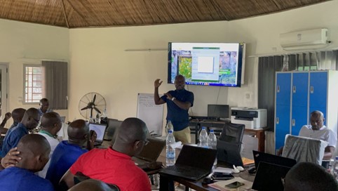
GisAction’s role extends beyond the technical development and implementation of the solution to ongoing support and training for technicians in using the application.
Benefits: Cost savings and safety
The benefits for stakeholders involved are many: with a few simple clicks, the progress of the works can be accessed, completely remotely.
This translates into extremely high resources and time saving, avoiding the need for travel to a remote areas of the park for work monitoring. Additionally, this solution transforms the data collection paradigm from physical to digital, innovating the tool and increasing its effectiveness for both data collectors and decision-makers who need to interpret it.

