In Rome, there are stories that risk remaining invisible: families facing housing, employment, or financial difficulties; citizens turning to local help desks seeking support and a listening ear. RomaInsieme was created to identify these needs and transform them into concrete knowledge, useful for building fairer and more targeted social policies.
The project began with Stand Up and continued with Nonnaroma, with the support of the Charlemagne Foundation, and was developed in close collaboration with gisAction, which has put technology at the service of people through a participatory and innovative approach.
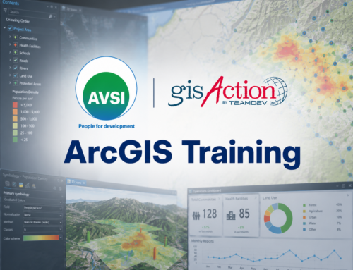
From listening to data: the power of GIS technology
The heart of the project is a digital questionnaire created with ArcGIS Survey123, administered to citizens through ADA (Agency for the Right to Housing) counters and a widespread network of associations present in the neighborhoods. It is not just about simple demographic questions, but includes sections dedicated to crucial topics such as:
-
employment and unemployment,
-
housing conditions,
-
access to services and local needs.
Each response becomes part of a larger picture: a geo-spatial snapshot of social vulnerabilities, continuously updated and shared with the community.
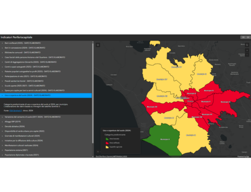
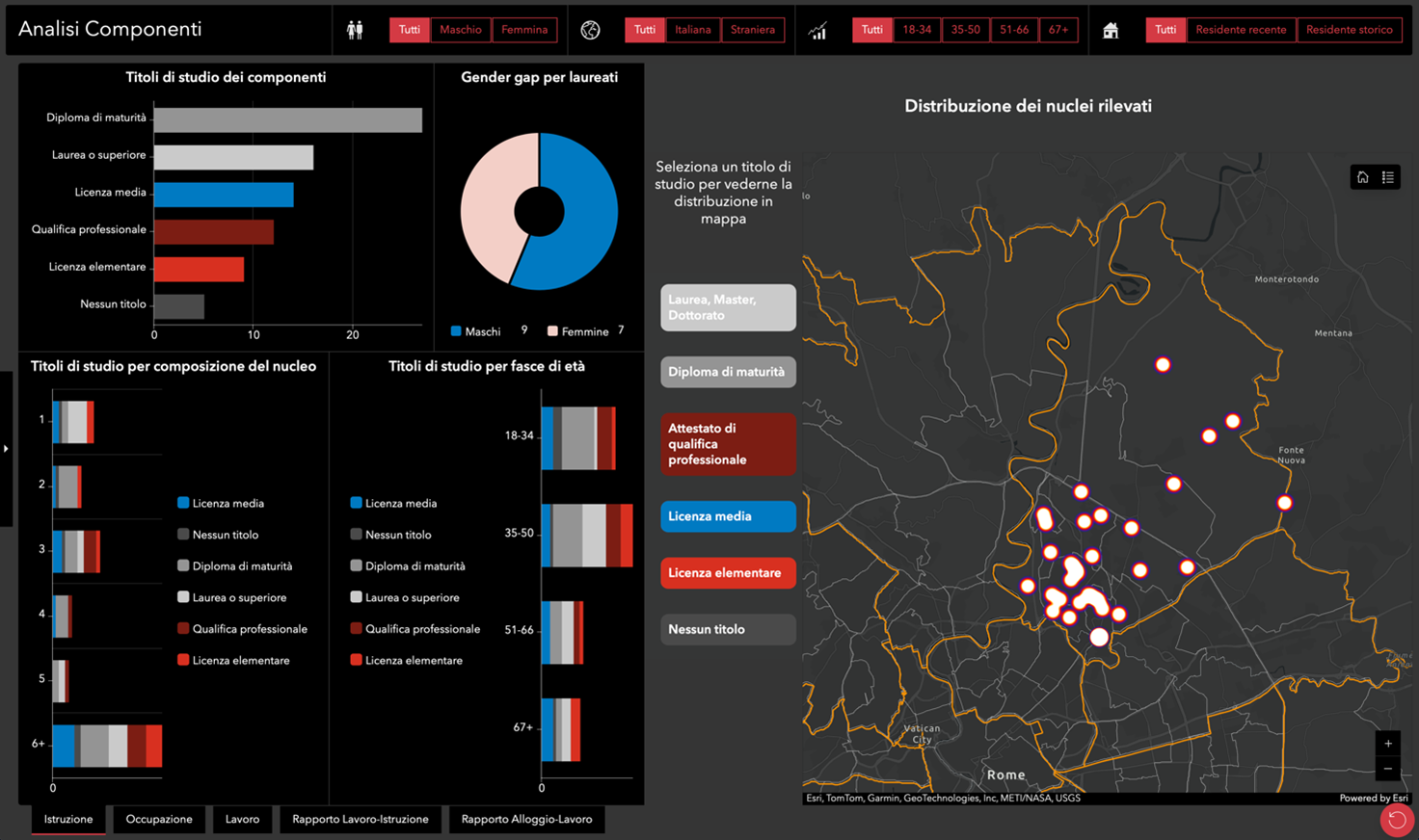
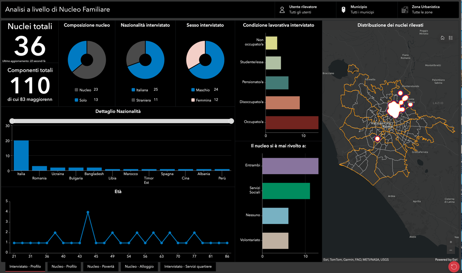
Interactive dashboards: turning numbers into action
The data collected do not remain locked away in an archive. Thanks to the co-design of interactive dashboards created with ArcGIS Dashboards, the information becomes accessible, clear, and useful:
-
one dashboard highlights family-level challenges (vulnerabilities, low income, housing issues);
-
another analyzes individual-level challenges, related to education, employment, and social inclusion.
Completing the system, a Dashboard Hub was also developed, designed as a central access point where citizens, associations, and institutions can explore a unified view of RomaInsieme. The Hub strengthens transparency, encourages participation, and creates a shared digital space where data becomes a common resource.
These tools make it possible to identify territorial patterns, compare socio-economic indicators, and guide institutions toward more effective interventions. In this context, digital inclusion means transforming the complexity of data into a collective resource capable of informing decisions.
A participatory project
RomaInsieme is not just about technology. It is, above all, a listening network that brings together trade unions, associations, Rome’s III Municipio, and the Department of Social and Economic Sciences at Sapienza University. Together with the volunteer association Nonnaroma and with the support of the Charlemagne Foundation, these actors have built a participatory model that highlights the “weak signals” of social distress before they turn into fully fledged emergencies.
The role of gisAction has been that of a digital enabler: providing advanced technological tools while keeping people at the center, simplifying the work of operators, and strengthening the ability of institutions to understand and respond to real needs.
Digital inclusion: the key to fairer social policies
The RomaInsieme experience demonstrates how GIS technology can be much more than just a technical support tool. It becomes a shared language that connects communities, institutions, and citizens. It becomes a bridge between people’s stories and the actions of public policies.
This is our vision of digital inclusion: accessible tools, reliable data, and participatory processes. Only in this way is it possible to build a city that leaves no one behind, transforming listening into concrete change.
Who we worked with
Periferiacapitale is a program of the Italian Charlemagne Foundation that promotes inclusive development in the neighborhoods of Rome. It collaborates with local associations, social cooperatives, and volunteers to address social, cultural, and environmental inequalities through training, events, and community participation.