How geospatial technologies support organizations in managing and analyzing migration flows

On this World Refugee Day, we stand in solidarity with millions of individuals who have been displaced from their homes due to conflict, persecution, or natural disasters. This blog post explore the role of GIS and geospatial technologies in support of organizations and institutions that plays a significant role in addressing the challenges faced by refugees.
Mapping Refugee Movements
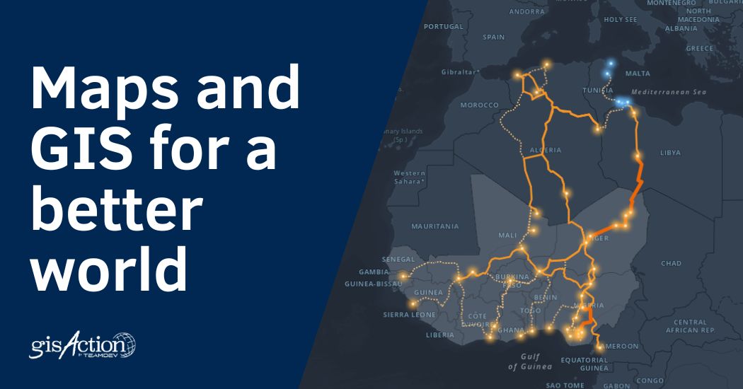
Geospatial technologies enable the mapping and analysis of refugee movements, providing valuable insights into migration patterns, routes, and hotspots. By leveraging Geographic Information Systems (GIS), humanitarian organizations can gain a better understanding of the journeys undertaken by refugees. This knowledge helps identify high-risk areas, plan efficient evacuation routes, and allocate resources effectively to provide timely assistance. An example of this is provided by the UNIDO research project “Observatory on Smuggling of Migrants,” which integrates digital maps – configured by gisAction – that track migrant routes based on data collected in the field and data provided by institutions. The work, of great importance in preventing smuggling of migrants, is freely accessible.
Emergency Management
During humanitarian crises, geospatial technologies offer crucial support in emergency response efforts. Satellite imagery and remote sensing enable the real time assessment of affected regions, helping identify areas with high concentrations of displaced individuals and assessing the extent of damage. This information guides the deployment of humanitarian aid, allowing organizations to provide essential resources such as food, water, and shelter to refugees in a timely and targeted way. UNOSAT (United Nations Satellite Centre) is part of the United Nations Institute for Training and Research (UNITAR) and provides satellite image analysis during humanitarian emergencies related to disasters, complex emergencies and conflict situations.
Access to Education and Healthcare
Refugees often face significant challenges in accessing education and healthcare services. Geospatial technologies can play a crucial role in addressing these barriers. By mapping the distribution of refugee populations and their proximity to educational and healthcare facilities, policymakers can identify gaps and develop strategies to improve accessibility. Additionally, real-time tracking systems can help ensure that healthcare services reach those in need, even in remote or inaccessible areas. GisAction has contributed to the implementation of the SaniMap project for mapping clinics that provide healthcare to foreign individuals without a residence permit, whose permit has expired, or who have never had one. Click the button to explore the project.
Advocacy, Policy Development and Storytelling
Geospatial technologies provide robust evidence for advocacy efforts and policy development concerning refugee support. By visualizing data on maps and leveraging geospatial analytics, policymakers can better understand the spatial dynamics of refugee populations, including their distribution, demographics, and needs. This information facilitates evidence-based decision-making, leading to the development of policies that address the unique challenges faced by refugees and promote their well-being. At the same time, geographical tools offer the possibility to enhance the storytelling activities of organizations, which are essential for raising awareness about the topics being addressed. Here is an example of a StoryMap created by gisAction for the “Archivio Memorie Migranti” (Migrant Memories Archive) to narrate Mahamed’s journey to Lampedusa.
On this World Refugee Day, we acknowledge the immense potential of geospatial technologies in supporting refugees and addressing their needs. By utilizing GIS, satellite imagery, and remote sensing, we can gain valuable insights into refugee movements, enhance emergency response, and facilitate access to essential services. Geospatial technologies not only provide critical information but also contribute to evidence-based policymaking and advocacy efforts.


