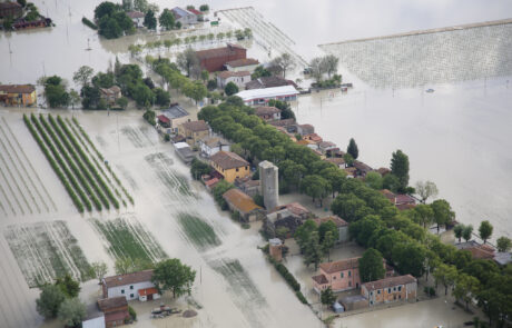
GIS for Conservation supports the surveillance and protection of natural parks. In addition, it provides managers with useful information on visitor safety and on the biomonitoring of environmental resources. In this way, the management of protected areas becomes more effective, coordinated, and based on up-to-date data.
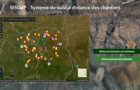
First, an advanced data ingestion solution integrates geographic, IoT, and GPS information. As a result, data collection from different sources is continuous and reliable. Moreover, information flows can be analyzed in real time. Thus, territorial conditions are monitored without interruption.
Subsequently, operational safety is strengthened by a geo-localized view of personnel. In this way, each operator can be located with precision. At the same time, the coordination of interventions improves. In addition, field activity control becomes faster and verifiable.
In parallel, remote monitoring of infrastructure enables optimized resource management. As a result, maintenance becomes more efficient and easier to schedule. Furthermore, risks to structures, paths, and facilities within parks are reduced. In this context, prevention plays a central role.
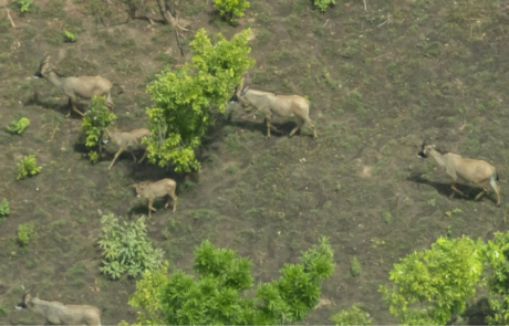
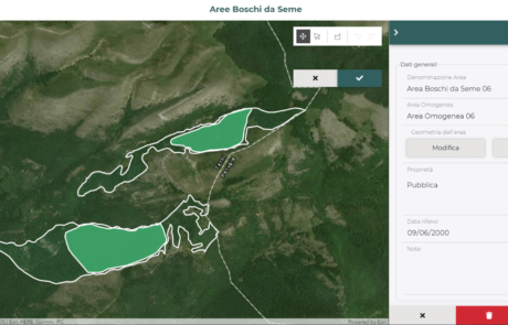
At the same time, biomonitoring focuses on flora and fauna. In this way, it is possible to observe the health status of ecosystems. In addition, imbalances, threats, and environmental changes can be identified. Thus, conservation strategies become more targeted.
Finally, a GIS-based decision support system synthesizes all collected data. For this reason, analyses become clearer and more accessible. In summary, GIS for Conservation enables informed decisions, improves the management of protected areas, and strengthens biodiversity protection. Moreover, it promotes more transparent environmental governance, effective cooperation among institutions, continuous territorial control, and lasting protection of natural heritage for future generations, in respect of ecological balances, public safety, and overall operational sustainability.