Maps, graphs and infographics for Save the Children Italy. All data and maps collected were organized as open data and made available to all.
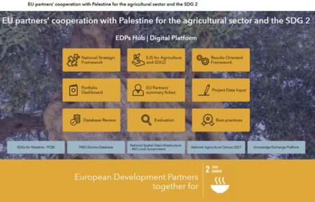
A digital hub to support donors’ cooperation | Palestine case study
Mari Minascurta2024-07-10T10:52:51+02:00Innovating cooperation: a digital hub for West Bank donors
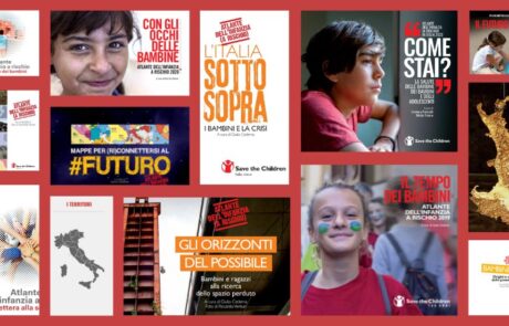
Save the Children Atlas of Childhood at Risk: data, analysis and geographies of Italian childhood
Mari Minascurta2024-09-04T12:38:04+02:00gisAction has been supporting Save the Children in this project since the 2011 edition of the Atlas and the main tool it uses is the GIS.

Protected: The Tenth Edition of the ‘Atlas of the Childhood at Risk
Mari Minascurta2020-06-29T14:54:25+02:00There is no excerpt because this is a protected post.
30 years in Asia
Mari Minascurta2024-09-03T12:07:01+02:00Co-participated design of the Storymap realized by gisAction and ASIA NGO, and geo referencing the of target locations where ASIA carried out its activities
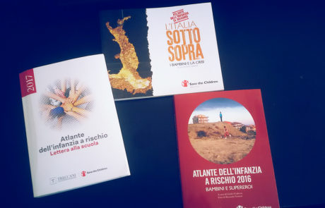
Atlas of Childhood at Risk, Save the Children Italia
Mari Minascurta2024-08-27T11:42:20+02:00Maps, graphs and infographics for Save the Children Italy. All data and maps collected were organized as open data and made available to all.