Geographical data sharing system and tools for the visualization of PTCP (Provincial Coordination Territorial Plan) datasets.
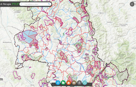
Geographical data sharing system and tools for the visualization of PTCP (Provincial Coordination Territorial Plan) datasets.
gisAction made available to public entities and NGO’s its staff’s experience in creation and maintenance of GIS systems.
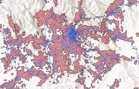
Implementation of a geographic database containing all the information on the sewage and purification system, the discharges of productive activities and the pressures produced in the territory.
gisAction solution to support the cooperation project is an innovative Monitoring and Evaluation system, the Monitoring Information System.