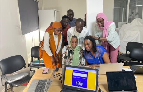
FIT! Senegal: the digital platform that transforms training and [...]
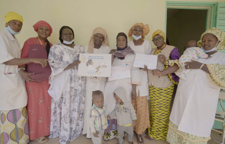
Terre des hommes in Mali: Improving Maternal and Newborn Health
Dina Berjawi2026-03-10T11:28:46+01:00Terre des Hommes & gisAction’s StoryMap Initiative for healthcare [...]
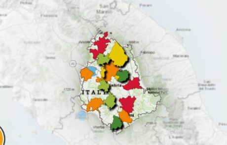
Urban Ecosystem: the map of Umbria’s greenest cities
Diego Mazzocchini2026-03-10T11:46:34+01:00The challenge for the sustainability of the top 15 [...]
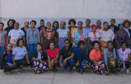
A Monitoring Information System for the “RIGENERA” project in Maputo, Mozambique
Mari Minascurta2026-03-10T11:51:54+01:00Digital and interactive mapping monitoring system to track field activities for the “Rigenera” project in Mozambique
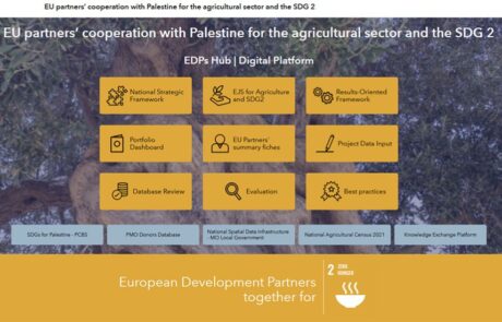
A digital hub to support donors’ cooperation | Palestine case study
Mari Minascurta2024-07-10T10:52:51+02:00Innovating cooperation: a digital hub for West Bank donors
From Words to Data: Save the Children’s Data Hub
Diego Mazzocchini2026-03-10T12:01:59+01:00An open virtual space for the constant collection and dissemination of information, data, analysis, and research on childhood and adolescence.
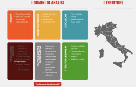
Monitoring poverty and inequality: the benefits of digital tools
Teamdev srl2026-03-10T12:04:03+01:00The StoryMap developed for the Litmus project chronicles the intervention to combat educational failure and school dropout in Rome's municipalities V, VI and VII
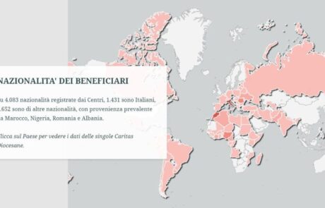
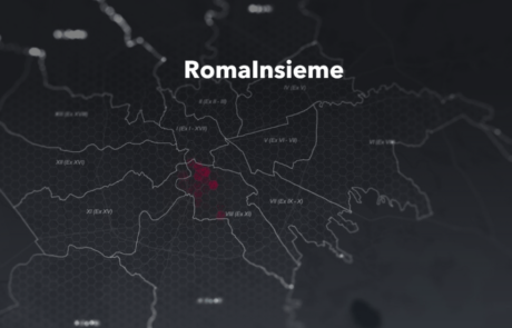
Caritas Report on Poverty: the StoryMap
Diego Mazzocchini2026-03-10T12:05:53+01:00The StoryMap designed for Caritas Umbria uses the potential of geographic storytelling to tell the story of critical poverty-related issues.
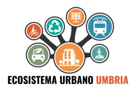
Innovating with data: the web app for Ecosistema Urbano
Diego Mazzocchini2026-03-10T12:29:08+01:00Development of a web app to visualize the data of the Ecosistema Urbano report of Legambiente Umbria
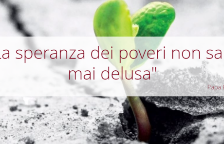
StoryMap for the Report on the Poverties – Caritas Umbria
Diego Mazzocchini2026-03-10T12:43:57+01:00"The hope of the poor will not perish for ever": a StoryMap to tell the story of poverty in Umbria.
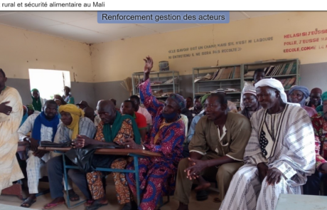
StoryMap for Rural development and Food Security in Mali
Diego Mazzocchini2026-03-10T12:46:08+01:00gisAction has been involved in the MLI/021 project by designing and implementing a StoryMap to support the initiative of rural development and food security in Mali.
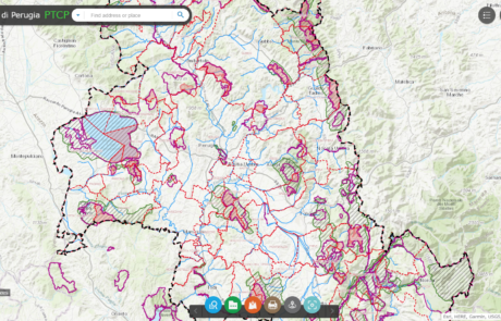
Platform for data sharing, visualization and collaboration built for the Province of Perugia
Diego Mazzocchini2026-03-10T12:49:57+01:00Geographical data sharing system and tools for the visualization of PTCP (Provincial Coordination Territorial Plan) datasets.