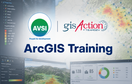
Supporting Operational Activities and Decision-Making Through GIS GIS [...]
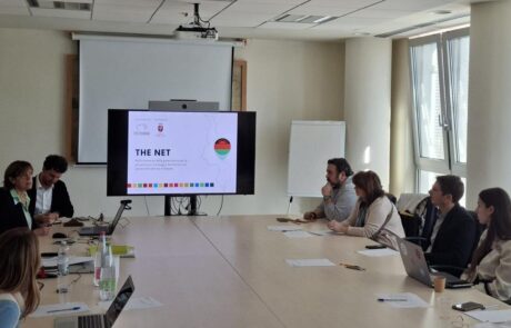
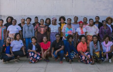
“THE Net” Project: How Health Intelligence Supports Women’s Health in Malawi
Dina Berjawi2026-06-17T11:05:21+02:00Modern international cooperation increasingly relies on infrastructure, organization, and, [...]
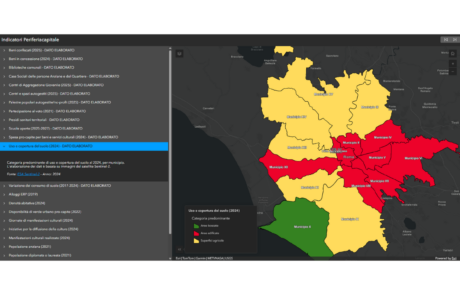
Social Mapping and GIS for Local Organizations in Rome
Dina Berjawi2026-06-10T16:36:21+02:00Social mapping is increasingly being used to understand the [...]

Digital Farmer Course
Diego Mazzocchini2026-05-14T16:21:45+02:00A course at the Apulia Digital Maker Technical Institute to train professionals in agriculture 4.0

Social enterprise Con i bambini
Dina Berjawi2026-05-27T13:12:19+02:00Beyond the map: a WebGIS system based on ArcGIS [...]
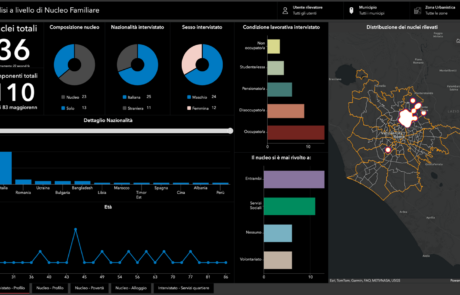
RomaInsieme – Digital inclusion to give a voice to social vulnerabilities
Dina Berjawi2026-03-10T11:59:30+01:00In Rome, there are stories that risk remaining invisible: [...]
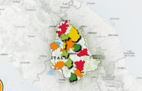
Urban Ecosystem: the map of Umbria’s greenest cities
Diego Mazzocchini2026-03-10T11:46:34+01:00The challenge for the sustainability of the top 15 [...]
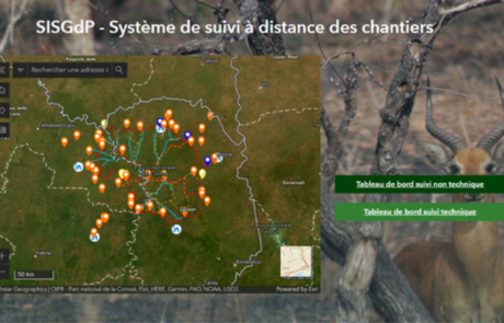
Remote Monitoring of Construction Sites
Diego Mazzocchini2026-03-10T11:48:52+01:00A solution for remote monitoring of construction sites developed by gisAction for Comoé National Park
A Monitoring Information System for the “RIGENERA” project in Maputo, Mozambique
Mari Minascurta2026-03-10T11:51:54+01:00Digital and interactive mapping monitoring system to track field activities for the “Rigenera” project in Mozambique
WisePark: Conservation of Comoé National Park
Diego Mazzocchini2026-03-10T12:18:00+01:00gisAction solution for the conservation project of Comoé National Park, in Côte d'Ivoire.

Hot Spot Analysis
Mari Minascurta2026-03-10T16:25:47+01:00Technical support and GIS analysis of spatial data for ARPA Umbria
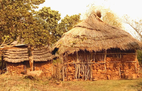
Monitoring Information System in eSwatini and Mozambique
Mari Minascurta2026-03-10T16:30:34+01:00gisAction solution to support the cooperation project is an innovative Monitoring and Evaluation system, the Monitoring Information System.