This content is password protected. To view it please enter [...]
Atlas of Childhood (at risk) 2023 – Save the Children
Diego Mazzocchini2023-12-14T17:29:58+01:00This edition of the Atlas focuses on the state of digitization in Italy among minors.
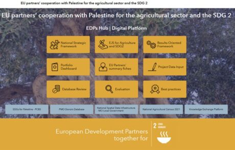
A digital hub to support donors’ cooperation | Palestine case study
Mari Minascurta2023-04-12T10:32:59+02:00Innovating cooperation: a digital hub for West Bank donors

Atlas of Childhood (at risk) – 2022 Edition
Diego Mazzocchini2022-11-21T16:41:51+01:00The Atlas of Childhood 2022 provides a view of the conditions of childhood in Italy.
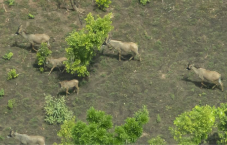
WisePark: Conservation of Comoé National Park
Diego Mazzocchini2023-03-27T15:10:44+02:00gisAction solution for the conservation project of Comoé National Park, in Côte d'Ivoire.
The census of the park Somaini – Arafat of Rome
Diego Mazzocchini2022-05-06T15:30:21+02:00gisAction has designed a workflow to support field census activities based on GIS tools.
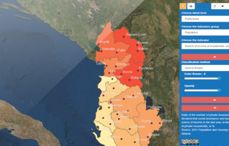
GIS to innovate Albania Census
Mari Minascurta2022-05-24T16:15:01+02:00The National Institute of Statistics of Albania (INSTAT) has introduced GIS technology into its population and housing census program with the support of gisAction
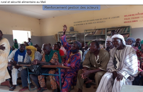
StoryMap for Rural development and Food Security in Mali
Diego Mazzocchini2021-08-19T16:33:03+02:00gisAction has been involved in the MLI/021 project by designing and implementing a StoryMap to support the initiative of rural development and food security in Mali.
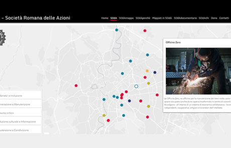
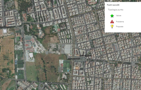
SOdA – Crowdsourcing application to create and update a collaborative map
Mari Minascurta2020-08-06T12:52:00+02:00SOdA was conceived as a free and collaborative map of initiatives, arriving from citizens, that take care of the well-being of the city and the people.

GIS assistance for public entities
Mari Minascurta2020-06-16T09:46:32+02:00gisAction made available to public entities and NGO’s its staff’s experience in creation and maintenance of GIS systems.
ARPA Umbria – The update of the Project on the Sewage and Purifying System
Mari Minascurta2020-06-16T09:52:21+02:00Implementation of a geographic database containing all the information on the sewage and purification system, the discharges of productive activities and the pressures produced in the territory.

A landmark in the landscape – Atlas of monumental and remarkable fruit trees
Mari Minascurta2020-06-16T09:52:26+02:00gisAction proposed the Story map as a tool for disseminating information on the presence of significant and monumental fruit trees in Umbria.