Discover the projects carried out by gisAction in the fields of international cooperation, territorial management, environment, and digital transformation of Sustainable Development actors. Our solutions based on GIS and Web GIS technologies, tools for collecting geolocated data, and for graphical and cartographic visualization of geographic Open Data, support NGOs, public authorities, and global institutions.
Explore the success stories that demonstrate how geospatial intelligence can improve planning, communication, and resource management.
Projects
- All
- GIS & mapping
- GIS for Climate Change & Disaster Risk Reduction
- GIS for Conservation
- GIS for Cultural Heritage
- Gis for Data Value Chain
- GIS for International Cooperation & MEAALS
- GIS for National Statistics
- GIS for Urban Regeneration
- Innover dans les flux de travail
- Mapping et SIG
- Measuring results
- Services
- Solutions
- Storytelling and Advocacy
- Workflow innovation
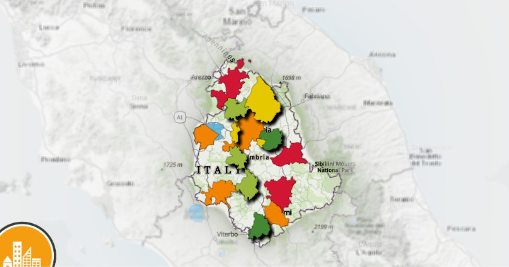
Urban Ecosystem: the map of Umbria’s greenest cities
The challenge for the sustainability of the top 15 [...]
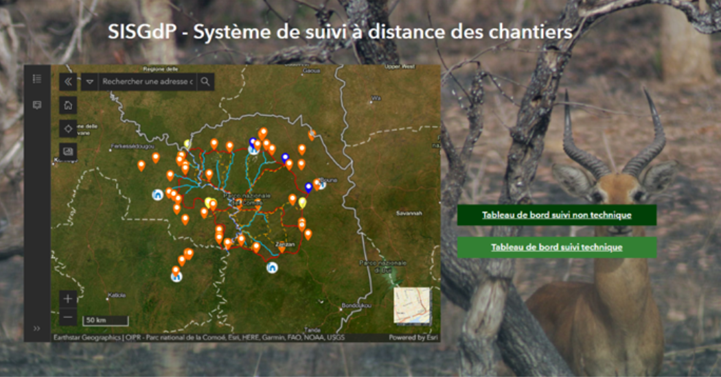
Remote Monitoring of Construction Sites
A solution for remote monitoring of construction sites developed by gisAction for Comoé National Park
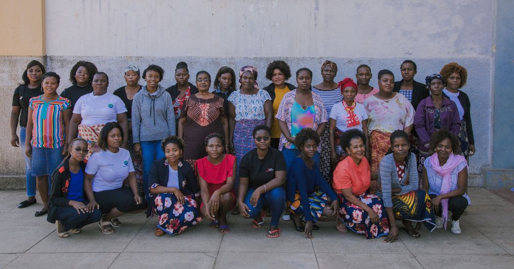
A Monitoring Information System for the “RIGENERA” project in Maputo, Mozambique
Digital and interactive mapping monitoring system to track field activities for the “Rigenera” project in Mozambique
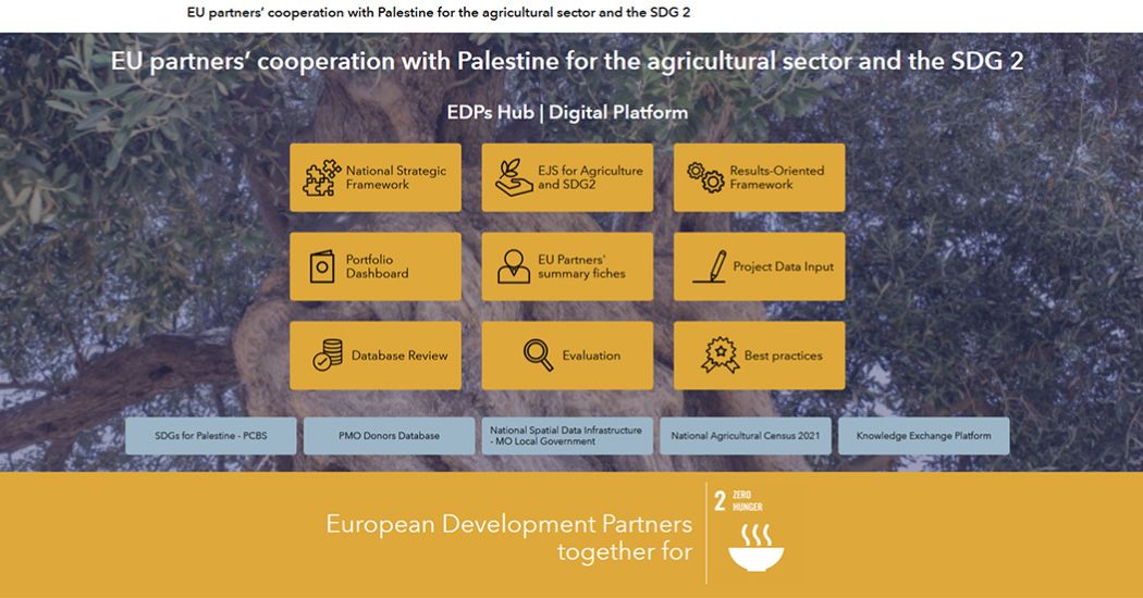
A digital hub to support donors’ cooperation | Palestine case study
Innovating cooperation: a digital hub for West Bank donors
From Words to Data: Save the Children’s Data Hub
An open virtual space for the constant collection and dissemination of information, data, analysis, and research on childhood and adolescence.
Monitoring poverty and inequality: the benefits of digital tools
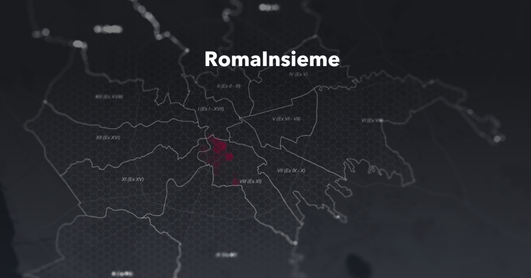
The StoryMap developed for the Litmus project chronicles the intervention to combat educational failure and school dropout in Rome's municipalities V, VI and VII
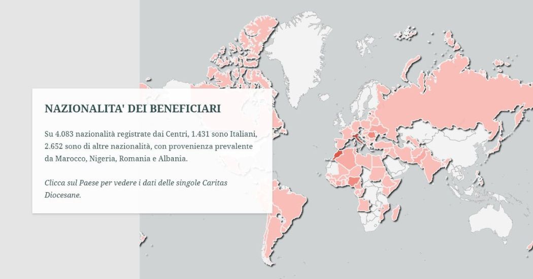
Caritas Report on Poverty: the StoryMap
The StoryMap designed for Caritas Umbria uses the potential of geographic storytelling to tell the story of critical poverty-related issues.

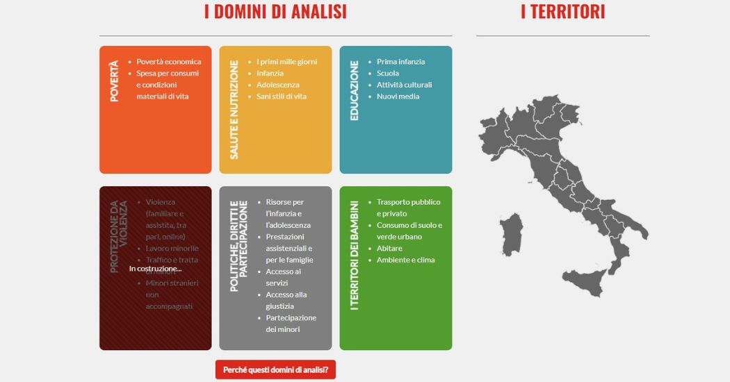
Atlas of Childhood (at risk) – 2022 Edition
The Atlas of Childhood 2022 provides a view of the conditions of childhood in Italy.
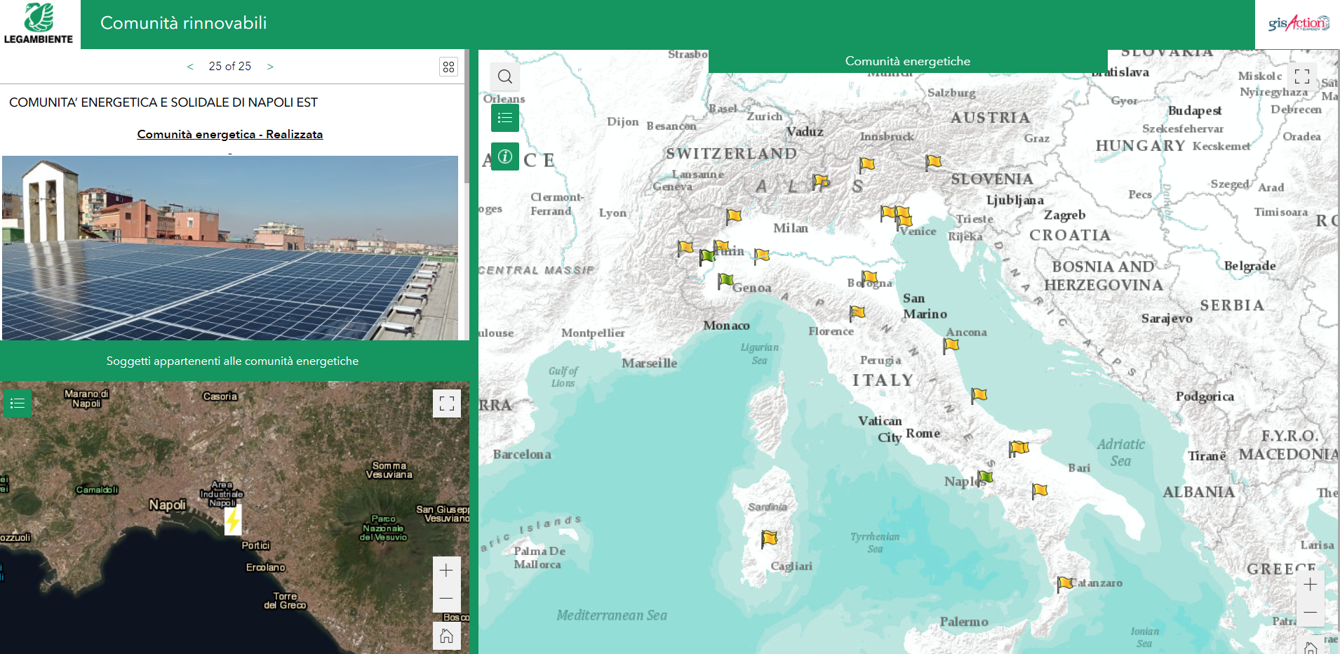
Legambiente Energy Communities
gisAction developed an application that allows the participatory mapping of the data of the Energy Communities in Italy.
Who We Have Worked With