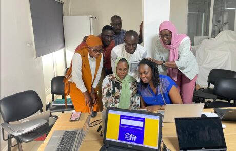
FIT! Senegal: the digital platform that transforms training and [...]
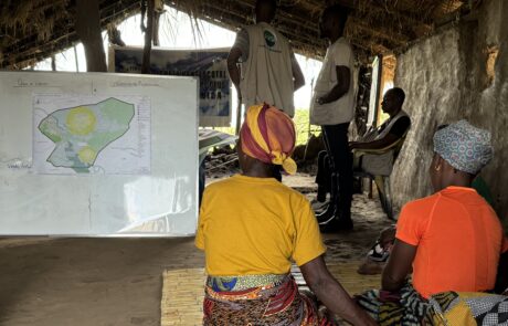
Building Resilience in Mozambique: Protecting Children from Natural Disasters
Dina Berjawi2026-03-10T11:13:12+01:00Mozambique is a land of immense natural beauty, but [...]

Unlocking the Secrets of the Caelian Hill
Dina Berjawi2026-03-10T11:15:51+01:00What if you could explore ancient ruins not [...]
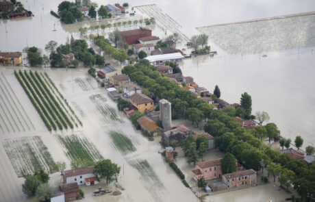
Ravenna’s Climate Told in a StoryMap
Dina Berjawi2026-03-10T11:18:45+01:00How Ravenna Turned Climate Awareness into Community Action – [...]
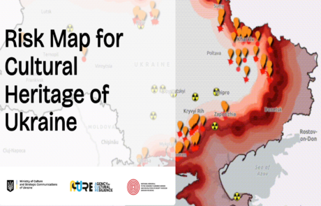
Risk Map for Ukraine Cultural Heritage: Data-Based Protection and Preservation
Dina Berjawi2026-03-10T11:24:03+01:00Risk Map for Ukraine cultural heritage: A data-driven approach [...]

Empowerment for the Elderly with Innovation
Dina Berjawi2026-03-10T11:26:09+01:00Technology and Innovation for a More Inclusive Community [...]
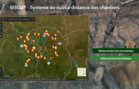
Remote Monitoring of Construction Sites
Diego Mazzocchini2026-03-10T11:48:52+01:00A solution for remote monitoring of construction sites developed by gisAction for Comoé National Park
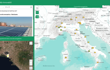
Legambiente Energy Communities
Diego Mazzocchini2026-03-10T12:14:31+01:00gisAction developed an application that allows the participatory mapping of the data of the Energy Communities in Italy.
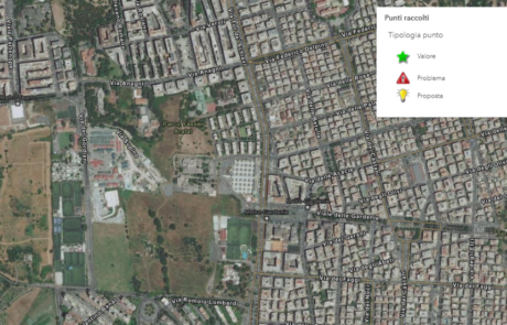
The census of the Somaini park – Arafat of Rome
Diego Mazzocchini2026-03-10T12:20:48+01:00gisAction has designed a workflow to support field census activities based on GIS tools.
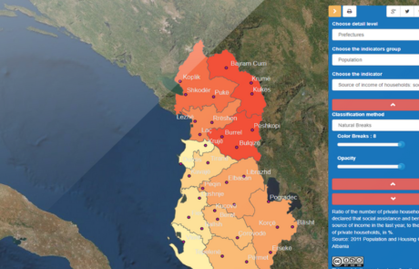
GIS to innovate Albania Census
Mari Minascurta2026-03-10T12:34:34+01:00The National Institute of Statistics of Albania (INSTAT) has introduced GIS technology into its population and housing census program with the support of gisAction

Geospatial technologies for the Generations and Gender Survey of Moldova
Diego Mazzocchini2026-03-10T12:39:16+01:00gisAction supporting the path of technological innovation of the statistical system of the Republic of Moldova
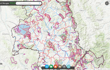
Platform for data sharing, visualization and collaboration built for the Province of Perugia
Diego Mazzocchini2026-03-10T12:49:57+01:00Geographical data sharing system and tools for the visualization of PTCP (Provincial Coordination Territorial Plan) datasets.